
The geology of the Iberian Peninsula is quite interesting and does not stop surprising us. Today we travel to mountains of Galicia that began to form 350 million years ago. Thanks to the collision between the two great continental plates called Gondwana and Laurasia, various geological points of interest for Galicia could be formed. We find several points that represent geological landmarks since its formation.
Join us in this article from the Paleozoic era to the present to know the impressive mountains of Galicia.
Folding of Campodola Leixazós
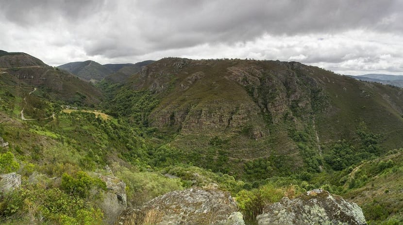
We began this journey through the mountains of Galicia through a fold that was declared in 2011 as a Natural Geological Monument and a Place of International Geological Interest. It is a geological structure that runs through all of Galicia and whose most visible outcrop can be seen in Courel. In geology, The formations and processes related to the folds of the land are studied. However, you cannot get to know him well in person and see the folds. In this case, we find the folding in all its splendor in such a way that we can see how the two continental masses collided.
After the collision of these two continental plates, a larger continent known as Pangea was formed. We can say that it is the first recognizable effect of the first stage in which Galicia was formed more than 500 million years ago. Thanks to this, it has the recognized title, since it is of special community interest.
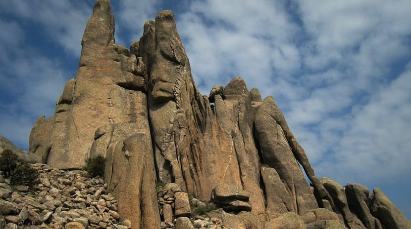
Sacred Peak

This is the second effect that can be recognized in the entire territory of the training stage of Galicia. It has a large deposit of quartz, granite land, etc. This part of the Galician mountains was composed as a result of the movements of the tectonic plates that took place during the Paleozoic about 400 million years ago.
This peak contains a very important point in the geological history of Galicia. That's where they were welded two tectonic plates colliding and formed the known geology. Originally, north of the dike where the high concentration of quartz is found would stretch what is known like Laurasia and, to the south, Gondwana, which is the one that would mark the border within Galicia.
Granite massif of O Pindo
Another point associated with this tectonic collision that we are talking about. It is recognizable even in current life and thanks to it you can learn a lot about the past. Granites were the first rocks to form in Galicia. This was about 300 million years ago.
The morphology of this massif refers to a magmatic body that was consolidated in the subsoil at a depth of about 20 kilometers. Since the geological agents As erosion has been at work for 300 million years, today we can see the entire surface where the Mesozoic era.
Cape Ortegal
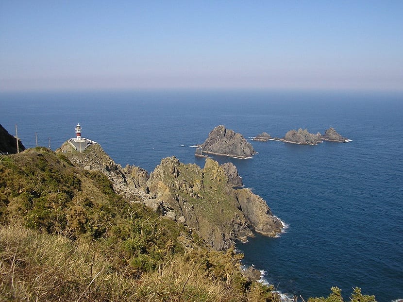
At Cabo Ortegal we find numerous cliffs that correspond to the second stage in which Galicia was formed. About 200 million years ago, at the beginning of the Mesozoic, the great continent known as Pangea began to fragment. Because of that, was unifying and separating the Iberian Peninsula. This movement was the one that caused the formation of the Galician coastline from north to west.
These cliffs are known as intraplate, because they were within the larger plate known as Pangea. It is not a cliff that has been formed by marine erosion over the years. Thanks to the fact that they were formed by the rupture of the major plate, they have been preserved very well. This is because geological agents have not been able to act for so long to cause this wear.
O Ézaro-Xallas waterfall

It is another part of the mountains of Galicia that it was formed 145 million years ago. The rivers that flowed over what is now Galicia could reach the sea and flow into it. The erosion that the rivers have been causing during all this time is the cause of the relief of the river valleys of Galicia.
River erosion has quite resistant rocks, although the river cannot excavate all the depth that the valleys have. The most visible case that we have of river erosion is the one that we can see in the waterfalls of the Xallas River.
Ourense Depression-source of the river Miño
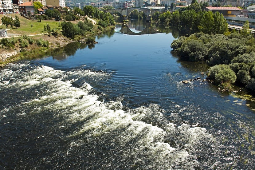
Another gem that we can see and that provides us with a lot of information about the geology of Galicia. We anticipate already up to as little as 2,5 million years. The entire Cantabrian mountain range extends further south until reaching Celanova. During its tour, it follows a system of tectonic trenches that have been active since the end of the Cenozoic. It is all these graves in common that mark the depression of Ourense through which the river Miño is born,
Parts of the river network that traveled throughout that area was diverted by the depression. Although the Miño river is the youngest of all the Galician rivers, It is the one with the most flow and, therefore, the most important.
Formation of Galician estuaries and dune processes

Dune formations have also taken place in the mountains of Galicia. The effects on the climate and its subsequent modification during the Quaternary was causing some obvious areas on the coastline. On the one hand, there were interglacial processes resulting from a warmer climate and other glacial phases with a cold climate. During the warmer periods, the ice was melting and the sea level rose. This caused the sea water to penetrate to the interior of the continent. This is how the estuaries were formed as we know them today. All the sea entered until the final stretch of the rivers, flooding everything.
The formation of the dunes corresponds to the processes with cold weather. At the moment, the weather was colder, so the sea level was lower. So it stayed the coastal platform more exposed and covered with sand due to the subjection of erosion.
I hope that with this information you can learn more about the geology of the mountains of Galicia.