
With the arrival of Easter, people are very concerned about what the weather is going to be like. The AEMET announces the arrival of a DANA along with haze that will intensify, especially in the south of the peninsula. Many people wonder what the weather will be like for Easter 2024.
Therefore, we are going to tell you what The weather will be like during Easter 2024.
Calima and a DANA to start Holy Week 2024
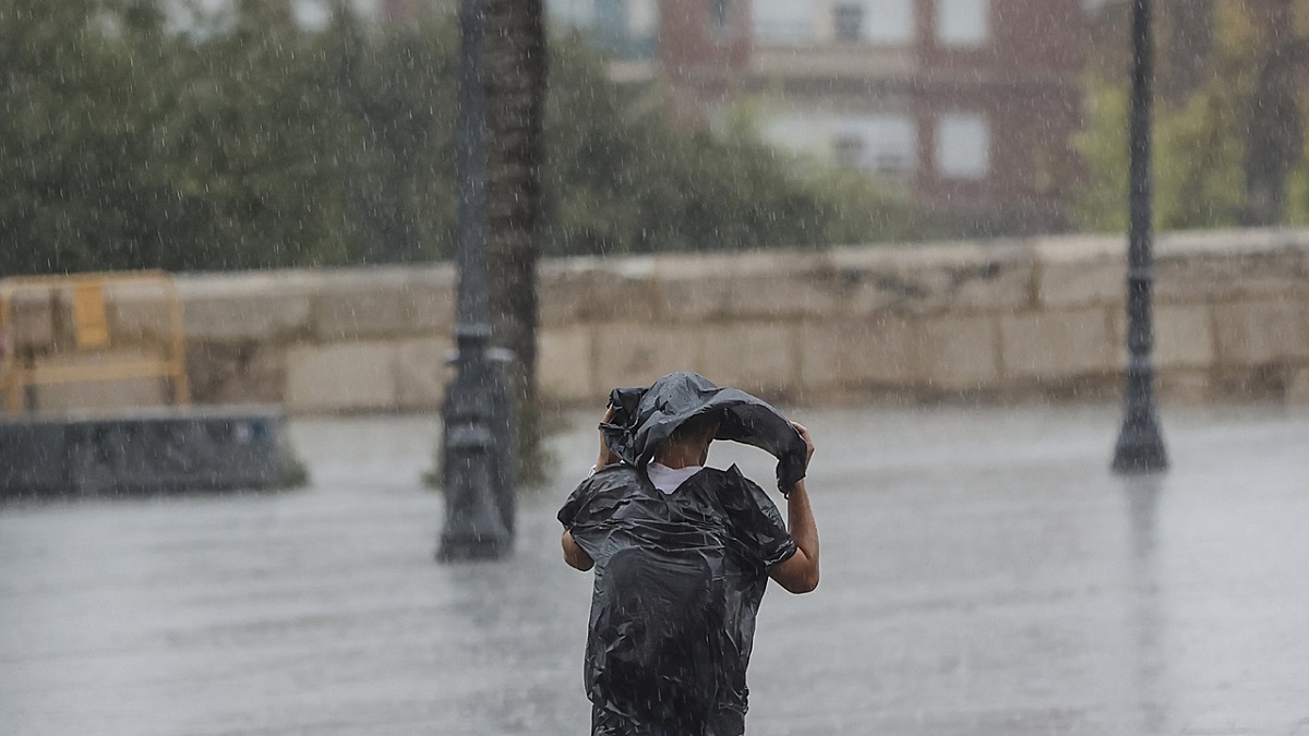
For the rest of the week, fog will take center stage as a prominent feature. The atmosphere will become unstable due to the development of a DANA, which will cause the appearance of thunderstorms and the precipitation of slushy rain.
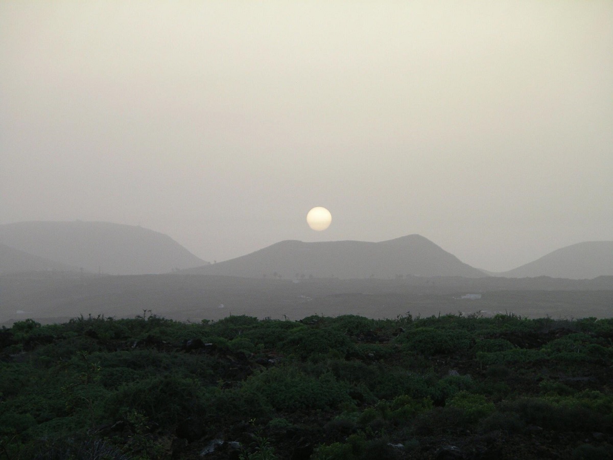
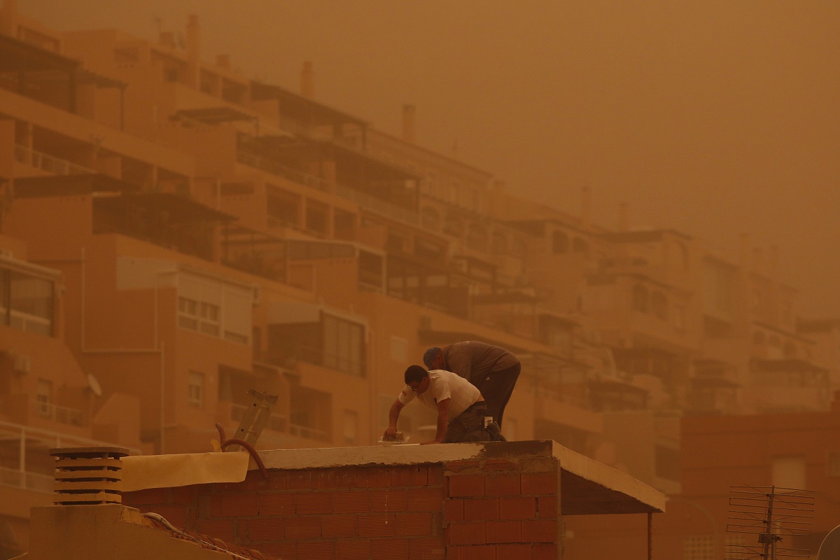
From the east of the Canary Islands to the southern half of the peninsula and the Mediterranean region currently extends a haze caused by suspended dust from the Sahara. This presence of desert dust in the peninsular skies will persist throughout the week, acquiring special prominence on Friday and Saturday.
This Tuesday, which also coincides with Saint Joseph's Day and the long-awaited celebration of the Valencia Fallas, we can expect anticyclonic weather conditions to continue. A warm, dusty air mass will prevail over most of the region. Besides, Coastal fog is expected in Tarragona, Castellón and the northern area of the province of Valencia.
As the day progresses we will be able to experience scattered showers and occasional storms, especially in the mountainous areas of the north and east of the Peninsula. Despite these meteorological variations, temperatures will remain relatively stable, with maximums around 25ºC in many cities.
Presence of a DANA in early spring
The beginning of astronomical spring is scheduled for tomorrow, Wednesday at 4:06 a.m. (Spanish peninsular time), accompanied by a time shift. The arrival of a trough of cold air from the western part of the Peninsula will amplify atmospheric instability, promoting the development of a DANA near the Gulf of Cádiz.
As a front advances, rain accompanied by storms is expected, some of which may be locally strong. These meteorological conditions will affect both the northern area of the peninsula and a wide strip that will run through the central region of the peninsula from north to south. High levels of haze will persist over the peninsula and the Balearic Islands, which will cause occasional muddy rainfall.
Temperatures will drop across the board and significantly, especially in Extremadura and the western provinces of Andalusia. On Thursday, a meteorological phenomenon known as DANA will be located between the Peninsula and the Canary Islands, and the Canary Islands will begin to feel its effects.. During the first half of the day, locally strong and stormy showers are expected in the Strait area and other regions, mainly in the southwestern quadrant of the peninsula. Atmospheric instability will intensify in the Canary archipelago. Showers accompanied by thunderstorms will become more widespread and intense as the day progresses.
The south of the peninsula will be more affected by the haze
The DANA will remain motionless on Friday. The Peninsula and the Balearic Islands will experience stable atmospheric conditions, thanks to the predominance of high pressures. However, stormy weather will persist in the Canary Islands, with the possibility of heavy rainfall. Throughout the day the winds will change direction and blow from the north in the Cantabrian region, causing some precipitation and a drop in temperature.
A new influx of Saharan dust is expected that will mainly affect the southern region of the Peninsula. This event is a consequence of the positioning of DANA and the existence of a low pressure system at surface level, which will transport dusty air from the north of Morocco to the southern part of the peninsula. This situation will have some resemblance to the March 2022 haze event, although we do not anticipate dust concentrations to reach such high levels.
Looking ahead to next weekend, it is expected that thick fog will dominate large regions of the Peninsula. Looking ahead to Saturday, a light drizzle will persist, with predominance in the extreme north of the peninsula. On the other hand, the Canary Islands are expected to experience abundant cloudiness and occasional rain. Temperatures will drop significantly in the northern part of the Peninsula, while they will increase in the southernmost regions. Strong north winds will blow on the Cantabrian coast and the Canary Islands.
The forecast for Sunday indicates that the prevailing anticyclonic conditions will persist in the Peninsula and the Balearic Islands, while in the Canary Islands the showers will progressively decrease, allowing clearer skies. The presence of elevated haze in the skies of the Peninsula and the Balearic Islands will be highlighted. Temperatures will be slightly cooler, except in the Cantabrian region where they are expected to increase. In addition, the Levante wind will gain strength in the area of the Strait and Alborán.
What is haze and how to protect yourself from it
Mud rain is a form of precipitation containing mineral dust, which eventually settles on the ground or other surfaces, giving the sensation of being splattered with mud.
The phenomenon known as blood rain is simply another term for mud rain. Despite its catchy name, This weather phenomenon is actually more common than we think. It occurs when rainwater carries sand particles from desert regions.
Now let's see what are the different guidelines that must be taken into account to protect yourself from the haze. Given the expected combination of rain and mud, it is essential to take precautions to protect yourself from its consequences. By paying attention to the guidance provided by local officials and staying up to date through reliable means, The repercussions of this atypical climate phenomenon can be effectively minimized.
In short, the fog that envelops Spain has the ability to affect the purity of the air and cause muddy precipitation. Maintaining knowledge and adhering to guidance to protect yourself are essential components to addressing this phenomenon.
I hope that with this information you can learn more about the haze and a DANA that we are going to have to start Holy Week 2024.