
In a previous article we were analyzing what it is and what consequences it has the cold drop. We saw as a conclusion that the concept of cold drop is misused by a set of erroneous statements that it carries with it. And is that the concept of cold drop is technically depression isolated at high levels. It is better known as DANA. This is a meteorological phenomenon that occurs every year and is characterized by adverse weather conditions that cause numerous damages.
In this article you will learn everything about DANA. Do you want to know more about it? You just have to keep reading.
What is DANA
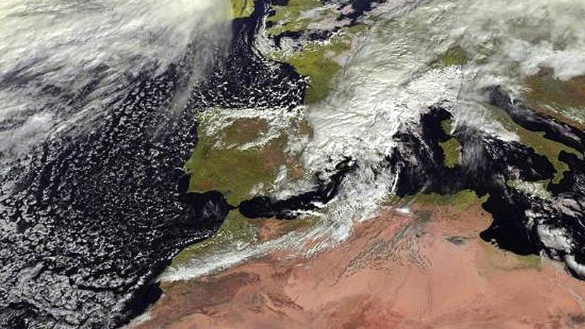
As stated in the article on the cold drop, it is a phenomenon that fully attacks the Mediterranean side of the Iberian Peninsula. It occurs as its name suggests is depression that is at high levels. The air undergoes a drastic change in the levels of atmospheric pressure and that form the torrential rains that can be seen in these times. The concept of cold drop refers only to the consequences caused by this depression isolated in height and is used colloquially to announce that we are going to have dangerous rain events.
However, experts in the field, and therefore those who know how the phenomenon works, have chosen the name DANA to explain the process by which it originates.
How it is produced
For DANA to form there have to be different types of conditions that are more likely at this time of year. For this reason, it is common that, on days close to summer of San Martín there are days when disastrous rainfalls occur, causing extensive damage.
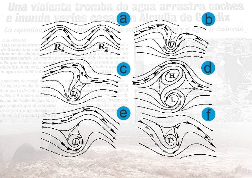
The first thing that is needed for the formation of this meteorological phenomenon is that the air of the jet stream circulates so that it forms dorsal numbers. Later, a stretching of the air currents to the south is formed caused by a drop in atmospheric pressure. The isolated part of low pressure appears as a consequence of the movement of the air towards the south.
As we have mentioned in other articles such as that of atmospheric pressure, an area of low pressure is indicating the direction in which the wind is moving. Air currents go clockwise in the southern hemisphere and counterclockwise in the northern hemisphere. It is this air circulation that gives rise to the formation of clouds of the nimbus cluster type producing strong storms.
The DANA is completely isolated from the ridge it was on and begins to go south. On the other hand, on many occasions it occurs that a high pressure ridge in the north of DANA. These are the good weather conditions characterized by high atmospheric pressure. For those who do not know, a ridge is an area of the atmosphere where pressures are higher than in the rest of the surrounding areas.
Where and when DANA is produced
DANA is most commonly produced in the fall season. This is due to the air that is still circulating in the maritime areas from the summer heat. The region most prone to suffering this type of event is the Mediterranean. It is in our peninsula where the polar air clash occurs that is advancing over all of Western Europe and with warm and humid air that comes from the Mediterranean Sea.
From the jet streams, being these the masses of cold air that come strong from the stratosphere (where the temperatures are very low), they are spreading over thousands of kilometers to have a great width of hundreds of kilometers. This large opening affects all of Peninsuka that ends up having torrential rains with high force in almost all places simultaneously.
The most common move DANA has it is a circulation of west-east orientation, although on some occasions it can go north-south direction, causing the air mass to bend until it breaks. When this displacement of the air masses takes place, one of them remains independent but very cold and isolated. This is the air mass that will cause these heavy rains with winds and storms, which we colloquially call cold drop.
The effects of this meteorological phenomenon are more intense the greater the the difference in temperatures between the cold mass of air that remains isolated and the temperature of the air that comes from the sea. If the sea is warm, the air mass will evaporate quickly and will condense when it reaches the cold mass, creating large clouds and generating enormous rainfall.
Consequences of DANA

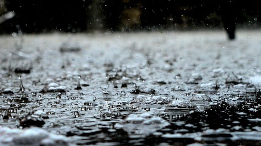
The problem that this type of precipitation generates is that the cities where it falls are not prepared for such amounts of water in such a short time. And it is that the sewers and the water distribution network reaches its limit and the well-known floods take place.
The effects of these precipitations on a specific city are due to planning and spatial planning. Each city has its PGOU (Urban Planning and Management Plan) which contains all the necessary aspects to prevent damage from the heaviest rains. The climate and its characteristics are included in the PGOU of an area. If, for example, a city suffers serious consequences from DANA every year, the most normal thing is that they try to create or order the necessary infrastructure to minimize the damage.
Floods cause extensive material damage and some lives are claimed each year in our country. Most of them by people who are trapped in vehicles, drowned or carried away by currents and / or river overflows.
As you can see, the cold drop is nothing more than the consequence or the colloquial name that is given to that isolated depression that occurs in altitude called DANA.