
We have seen throughout this blog numerous types of weather phenomena from the most common to the strangest. In this case we are going to talk about the norted. It is a mass of air from the arctic that lowers temperatures drastically. This causes the snow levels to begin to drop and to give rise to heavy precipitation with snow.
In this article we are going to tell you what nortada is, what its characteristics are, origin and possible consequences.
what is nortada
During this year the calendar told us during the month of April that spring was coming. Nevertheless, temperatures were remarkably low to unusually cold during that month. It is the presence of a nortada. As Holy Week arrived, it seemed that winter was coming back.
The nortada is a meteorological phenomenon whose origin is a cool northern winter that blows continuously for a while. It is a meteorological phenomenon that is often confused with cold waves. However it is not the same.
The forecast of the meteorological conditions for the days of the month of April and its drop in temperature were not due to a cold wave. To speak of a cold wave, there must be a drop of at least 6ºC in 24 hours, affecting at least 10% of the territory for three days or more. Meteorologists point to the lowest temperatures that must be recorded in different parts of Spain to be considered a cold wave:
- On the peninsular coast, the Balearic Islands, Ceuta and Melilla: the minimum temperature must reach the threshold of 0ºC.
- In areas where the altitude is between sea level and 200 meters: the minimum temperature must reach a threshold between 0 and -5ºC.
- In areas between 200 and 300 meters above sea level: the minimum temperature must reach a threshold between -5 and -10ºC.
- In areas between 800 and 1.200 meters above sea level: the minimum temperature must reach a threshold below -10ºC.
arctic air mass with snowfall
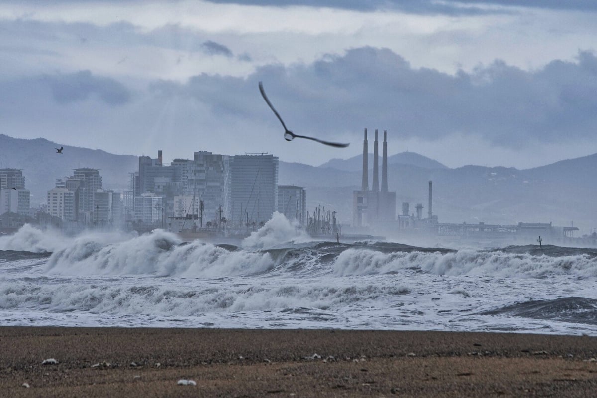
The nortada took its first steps on Thursday, March 31, with cooler temperatures and precipitation in northern Spain as the arctic air mass advanced. Temperatures dropped significantly in the northeastern third of the peninsula as of Friday, April 1, as the extremely cold air mass driven by the European storm moved southeast, according to Aemet forecasts. In addition, the strong northwesterly winds that accompanied the aforementioned descent increased the heat and cold in the northeastern third of the peninsula and the north of the Mediterranean region.
Temperatures between April 1 and 4 were unusually low during the spring since April is unusual in that snow does not usually fall in the extreme north of the peninsula.
The cold weekend was worthy of the harshest winter, with widespread frosts in the northern half and the interior of the peninsular southeast. Snow continued to fall in those areas on Saturday, although with less intensity. The instability of the situation made it difficult to make precise forecasts for the coming week.
nordic temperatures

The National Meteorological Service (Aemet) warned that temperatures would drop by about 15 ºC and would be below normal with strong frost. Especially during the morning, the sunrises were total winter.
Snowfall fell significantly. The snow levels they were less than 600 meters, or even 400 meters. In the Penibético, snowfall fell to 900 meters. There were also heavy snowfalls in the eastern Cantabrian Sea and the Pyrenees, with some 50 centimeters or more of snow in a few hours. In France and southern Germany, snow fell in some cities at very low elevations.
Differences with cold snaps
A cold wave is a phenomenon in which the temperature drops sharply due to the intrusion of a large amount of cold air. This situation lasts more than a day and can extend to hundreds or thousands of square kilometers.
There are two types:
- polar air massess (polar waves or waves of polar cold): They form between 55 and 70 degrees above sea level. Depending on where they go, they go through some changes or others. For example, if they move towards warmer regions, they heat up and become unstable in the process, which would favor the formation of storm-like precipitation clouds; instead, if they move towards the Atlantic and the Pacific, the air will be full of humidity, and when it comes into contact with fresh water, a fog bank or a weak cloud of precipitation will form.
- Arctic and Antarctic or Siberian air masses: Originating in areas near the poles. They are characterized by their low temperature, high stability and low moisture content, which practically does not produce turbidity. They generally don't produce much snow unless they pass through the Atlantic Ocean, as doing so would make them unstable.
To avoid problems, it is very important to wear warm clothes to protect yourself from the cold, if possible, enough pants, sweaters and jackets, instead of a lot of clothes, which can be uncomfortablea. Likewise, it is important to protect the neck and hands, otherwise we can catch a cold in less time than we think. If we are sick, we should see a doctor and avoid going out until we get better. If you must drive, you should check the weather forecast and be aware of chains that can be used, especially if you must pass or go into snowy areas.
The longest wave was recorded in the winter of 2001-2002, with a duration of 17 days, although in the 80s, especially in 1980-1981, there were 31 wave days, although divided into four episodes. Looking at the affected areas, the provinces most affected by the cold wave were the winters of 1984 and 1985, with a total of 45 provinces, compared to the 44 provinces that were affected by the cold wave of 1982-1983 a few years ago .
I hope that with this information you can learn more about what a norteda is and how they differ from cold snaps.