
Both for professionals and for any type of person, a topographic map it is a great tool. And it is that it is a type of map whose uses are enormous and for a large number of fields both in science and in spatial planning. Its main features are quite useful for many people.
Therefore, we are going to dedicate this article to tell you all the characteristics, utilities and the great amount of information that can be obtained from a topographic map.
Key features
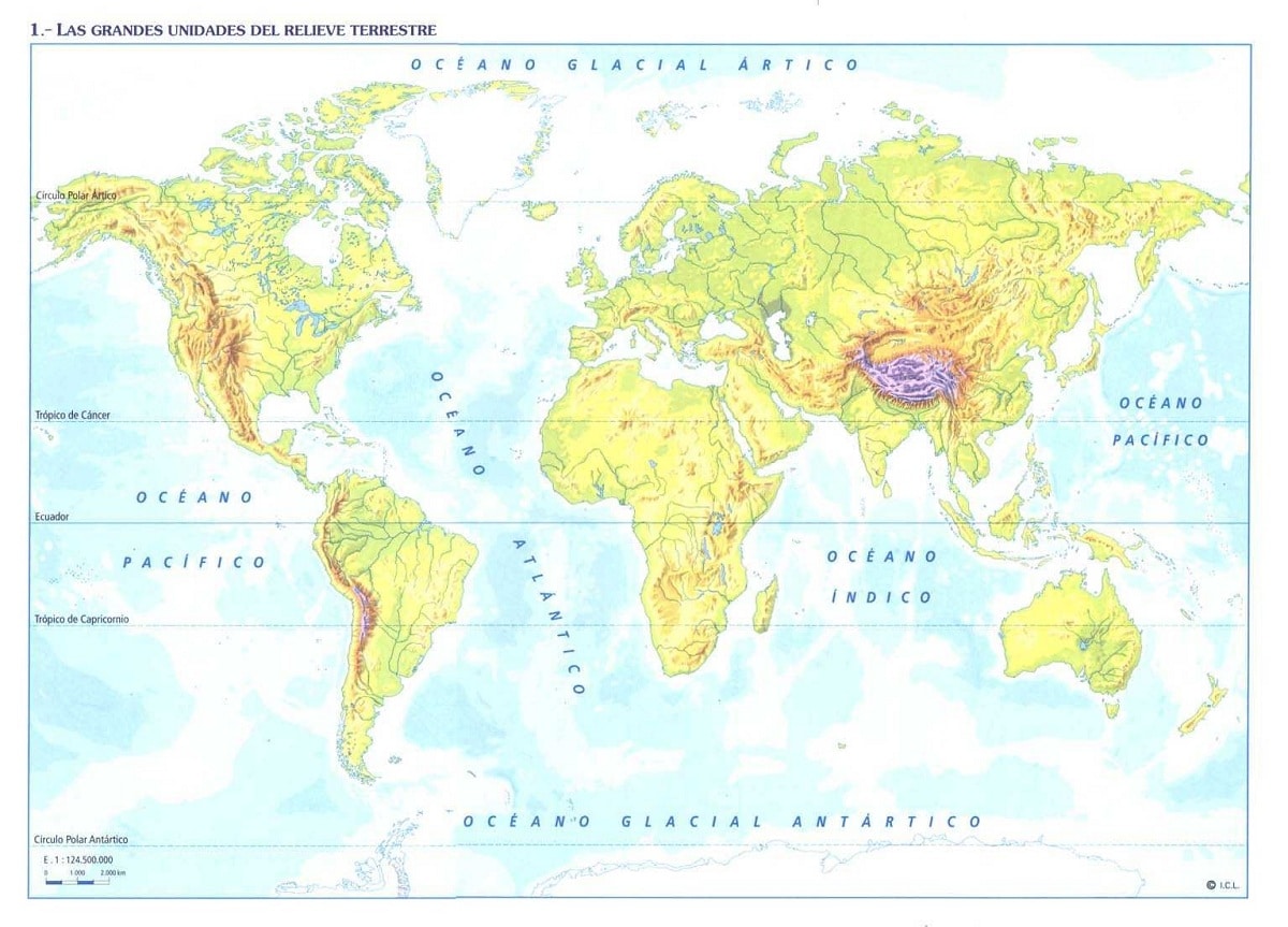
A topographic map is nothing more than a representation of the relief of the earth's surface. The most normal thing is that it is a representation of what is made of a specific area. Keep in mind that this area is represented to scale. The main difference with topographic plans is that the area that presents itself to me is much wider. On some occasions, topographic maps of provinces, regions, and even countries and continents can be created.
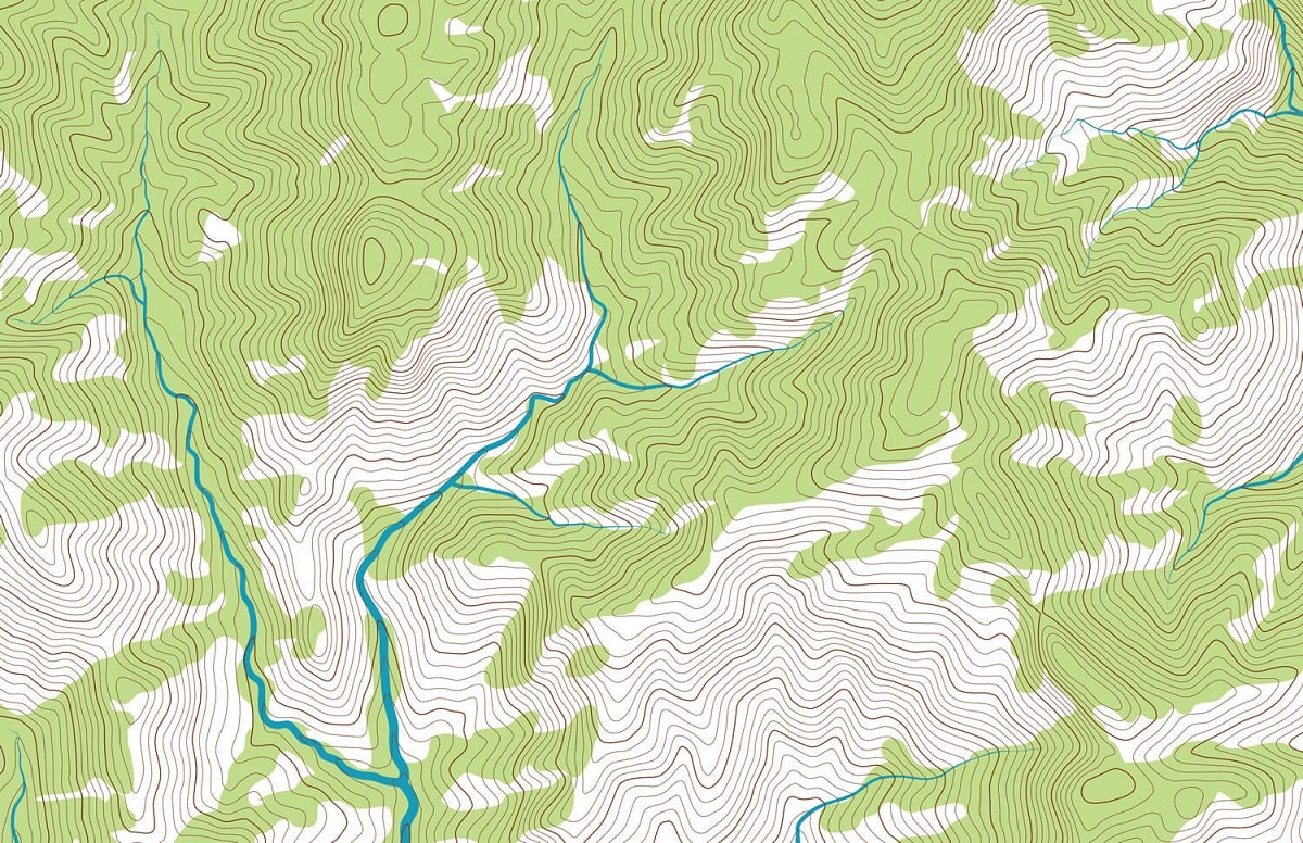
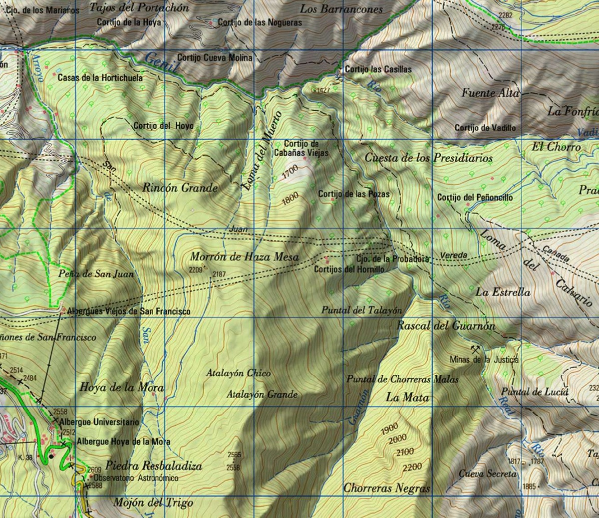
The contour lines of a topographic map are the essential part of any type of map. Thanks to the contour lines you can know the shape of the earth's surface and its inclination. In this type of maps, various symbols are used to distinguish the different elements. Thanks to all these symbols and colors they can be distinguished rivers, mountains, valleys and other features and elements of the terrain.
The topographic maps include a large amount of useful information about towns, roads, bridges, dams, human constructions or power lines among many other things. Today, there are numerous publishers and public services offering topographic maps. Depending on the institution or publisher, they can be topographic maps of very large areas of specific regions.
Elements of a topographic map
Let's see what are the main elements that a topographic map should include. For it to be considered as such, several things must be included in a mandatory way. We are going to see which are the main and essential points that should appear in any topographic map:
- The scale that has been used.
- The direction of geographic north
- GPS
- The direction of magnetic north
- All symbols used
- Relationship that exists with other planes
- Author of the map or organization that created it
- Year of elaboration
These are the main elements that do not fail in a topographic map. We know that a large amount of information is collected in this type of map. Hopefully, all this information should be well interpreted. We are going to group the main points to take into account the type of information that can be obtained from these maps:
- Population nuclei and isolated buildings. In a topographic map, information can be obtained about the existing population centers in a specific region and all the buildings farthest from said urban nucleus.
- Ways of communication. These communication routes are divided into roads, highways, railways, etc.
- Hydrography. It has to do with the amount of water or the presence of rivers, lakes, reservoirs, etc.
- Are the unevenness of the terrain and the altitude at which the areas represented on the map are located.
- Administrative boundaries of the territories. Not only the natural limits are shown, but also the administrative ones.
- Vegetation. There is no detailed list of the types of plants that exist, but the main species.
- Coordinates: They are necessary for the location of the represented places.
Description of the elements of the topographic map
We are going to describe in more detail which are the elements that belong to the topographic map.
- Level curves: are those that are responsible for showing the elevation of the terrain. They are the most representative characteristics of this type of map. Contour lines are responsible for joining the points that are at the same height above sea level. Therefore, they will be points that have identical altitudes.
- Conventional symbols: In addition to the contour lines, a large amount of information is also displayed. All this information is shown from symbols and signs to represent rivers, urbanized areas or points of interest. Colors are also used for various functions. For example, the color brown is often used to indicate areas of high elevation. Green is used to indicate forest areas or large meadows and blue to indicate water. Some roads and paths well differentiated with other colors.
- Sample curves: the altitude between two contour lines is used in this type of map. This is known as equidistance. To see the difference in altitudes more clearly, a thicker line is used every 4-5 contour lines called the master curve. It is used to indicate the altitude and to better calculate the equidistance.
- Scale: we know that reality is represented in any type of map. Obviously, not all sizes of objects and elements can be represented at their real scale. Therefore, the scale is applied. The most common scale that is usually used is 1: 50.000. This tells us that a unit on the map is 50.000 units in reality. For example, two centimeters on the map would be one kilometer in reality.
- Pending: The slope is the relationship that exists between the unevenness that we have to overcome and the distance that exists on the horizontal.
Main uses
We are going to see what are the main uses that are given to topographic maps. They can have a large number of uses and can be used by anyone for a variety of purposes and with ease. The most common uses are as follows:
- Geographic planning
- Large-scale architecture
- Earth sciences
- Electric engineering
- Mining
- Hiking and other leisure activities
- Large-scale architecture
- Civil Engineering
From this type of maps, geographic information systems are configured through the use of technology. These systems gather a large amount of information in the form of layers that then serve to know a large amount of information about a specific place. For example, the land uses of an area.
I hope that with this information you can learn more about the topographic map and its characteristics.