
We have started winter and the first deep storm is coming to Spain. His name is "Bruno" and it approaches from the Atlantic to western Europe. From today Tuesday, this storm will attack several areas of the Peninsula and the Balearic Islands.
Do you want to know the details about this storm?
Squall Bruno

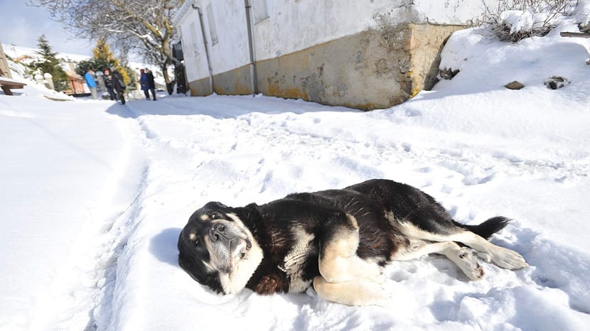
Bruno will leave abundant rainfall in the Galician and Cantabrian areas, also leaving snowfall. The snow will be significant especially in the more mountainous areas of the north and northwest of the peninsula.
The State Meteorological Agency (Aemet) has announced in a statement that temperatures throughout the day will drop in a generalized way. As for the snow level, it could descend up to 700/1000 meters in the north and up to 1000/1200 meters in the downtown area.
If the expected snow falls, it is possible that in the Pyrenees and the Cantabrian Mountains up to 20-30 centimeters of snow will accumulate, and in the Central and Iberian System up to 5-10 centimeters.
The center of the storm is not in our country, it is in the English Channel, the entire Mediterranean area and the Peninsula will be affected in its radius of action.
Bruno's situation is as follows: during this afternoon it will be seen how the most active front enters the Galicia area. From there, the rainfall will spread from west to east throughout the afternoon and evening on Wednesday. This storm will affect almost the entire area of Spain, although rainfall they will be less likely in the most southeastern part of Spain.
Rainfall will be persistent and locally strong, with probable storms and hail, in areas of Galicia and the Cantabrian Sea.
The wind as an increase in the force of the storm
As we know, wind is a fairly general adverse factor that contributes to storms being more intense and dangerous. In this case, we will also have generalized winds. They will begin to blow from the northwest of the peninsula this afternoon and will spread throughout much of the country during this early Wednesday morning and will diminish as the day progresses from the northwest tomorrow.
The west component wind is expected to reach very strong gusts in much of the Peninsula and in the Balearic Islands, being able to exceed 100-110 km / h in areas of the northwest and north of the peninsula. and 70-80 km / h in the rest of the areas and in the Balearic Islands.
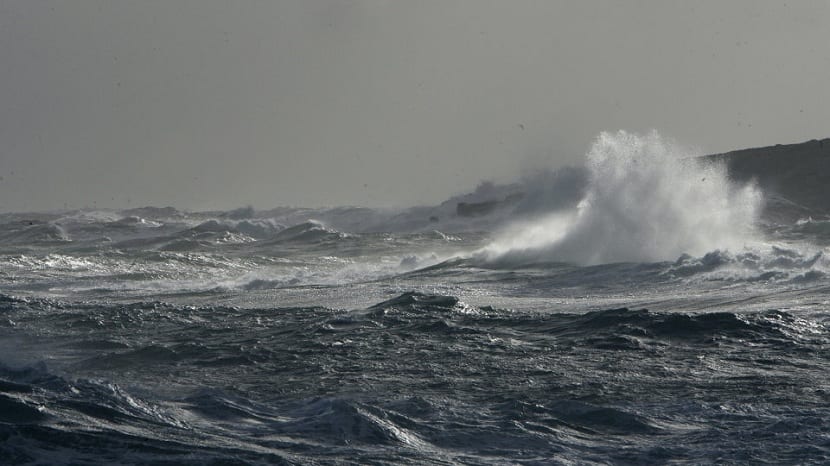
For the maritime zone, strong winds are expected on the western component of the Cantabrian coast of Galicia and with a force of 7 to 8, causing waves between 6 and 8 meters high. On the shores of the Mediterranean the force will be 7 and in the Balearic Islands it may reach force 8, Catalonia and the southeast of Andalusia, reaching waves of 3 to 4 meters.
New weaker front
As of Thursday, another new front will enter, although this is less strong, but we will have a somewhat more adverse weather situation like these days, with the most significant snowfalls continuing around the Pyrenees area.
This front is not as strong as Bruno, that's why it has no name. Aemet gives its name to those strongest storms that come to Spain from the Atlantic and that are capable of causing serious damage to people's property. For this reason, the Aemet names them so that the communication of the characteristics of the front is more effective.
Bruno will be the second named squall after Ana, who hit us a few weeks ago, when it was still autumn. This will be the first named storm this winter.
For those who do not yet know what storms are, they are a type of depression (a type of cyclone) that forms in mid-latitudes and the wind is turning in an anti-clockwise direction in the northern hemisphere. This spin in the air causes precipitation and wind to form and temperatures drop.