
the powerful squall Ephraim, named after the Portuguese meteorological agency IPMA, will not only affect the territory of neighboring countries, but also Spain in various ways. It had previously been monitored by the National Hurricane Center and designated Invest 99L, an intense subtropical cyclone.
In this article we are going to tell you about the characteristics, origin and danger of the Efraín storm.
Origin and characteristics of the Efraín storm

Storm Ephraim originated from an active subtropical cyclone monitored by the NHC's National Hurricane Center a few days earlier. the nhc gives it a 50% chance of becoming a named subtropical storm, who would have been called Owen. He only rated it Invest 99L when he was well to the southwest of the Azores. Although the hurricane brought very strong winds over a wide area of open water, it did not become a subtropical storm.
A few days earlier, the powerful Invest 99L cut through cold waters toward the Azores, losing some of its subtropical organization as it interacted with a polar trough that rapidly intensified into a powerful mid-latitude squall. On its south side, Efraín is associated with a strong river of atmospheric humidity and a rainfall belt of subtropical origin, that would be redirected towards the peninsula.
Farther north, a powerful blocking anticyclone prevented Efrain from moving naturally to higher latitudes. Most likely, the Efraín storm moves towards the Iberian Peninsula after sending a very effective rainfall band, a secondary low pressure trough separating from the mother storm, heavy seas, etc.
Impacts of the Efraín storm
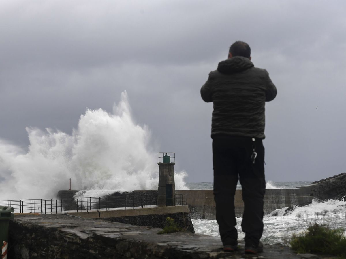
Ephraim received the name of the storm due to the severe impact of strong winds, heavy rains and rough seas in the Azores. The storm will then move slowly across the North Atlantic and may move towards the peninsula in a weakened but somewhat active form.
Rainfall is guaranteed in most of Spain, especially on the Atlantic coast and in the south of the peninsula, where it can be very abundant. Keep in mind that the Efraín sine will remain almost unchanged until Wednesday the 14th, while it sends us the precipitation band and the secondary pressure sine. The storm will approach in the second half of next week.
As previously mentioned, Efraín has a river with strong atmospheric humidity, RAH, associated with its southern flank, accompanied by strong winds. You can relate later. When the deep storm is close to the Azores, these rivers with precipitation bands will recede towards the Iberian Peninsula.
Precipitation and storms
We will have fronts and associated rain due to these RAH. The Efraín storm will be driven by a strong air flow from the west and will gradually move towards the peninsula starting in the middle of next week, bringing abundant rains again.
In short, the powerful storm Efraín will join the carousel of storms and fronts that affect us these days and will bring us a new batch of rains, heavy seas and strong winds in the coming week.