In the world of meteorology, maps that represent the situations of winds, storms, anticyclones, etc. are very important. To be able to predict the weather. Weather maps are nothing more than graphic representations that help us to know the values that certain meteorological variables have over a specific geographical area. Among all meteorologists they make use of these maps, since their use provides a lot of knowledge and an interesting image about all the situations that we can find in the atmosphere.
In this case we are going to talk about rain or precipitation maps. Do you want to know how these maps work and in what way they help to predict the weather?
Atmospheric variables

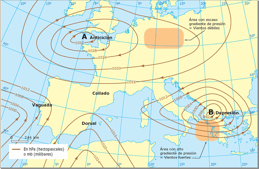
To find out what the weather will be like the next day, meteorologists study some of the most important meteorological variables that provide more information about the atmosphere. One of the variables that provides more information is atmospheric pressure. At the earth's surface, the atmospheric pressure is marked on an isobar map. Isobars are the lines where the atmospheric pressure is the same. Therefore, on maps where widely separated isobars can be observed, it will mean good weather and atmospheric stability.
On the other hand, if the isobar map has numerous lines together, it means that a storm or cyclone is approaching. But a question arises in all this, why do the lines with equal atmospheric pressure indicate that a storm is approaching? The relationship between atmospheric pressure and the possibility of precipitation is as follows. The closer the isobars are, the greater the intensity with which the wind blows and, therefore, there will be more atmospheric instability. This instability can cause rain as we will see later.
With the isobar lines it is also possible to know if the coming wind will be warmer, wetter, if it comes from the Pole or if it is from the continent. If on the isobar map we find an area where the atmospheric pressure is higher, an "A" is placed and it means that there is an anticyclone. This is an area of great atmospheric stability, since the movement of the air is downward and avoid the formation of cloudiness. Therefore, in this type of situation it is very difficult for it to rain.
On the contrary, if the pressure begins to decrease, at the point where the value reaches the minimum a "B" will be placed and it is said that there is a zone of low pressures. In this case there will be greater atmospheric instability and there will be more conditions for rain to form. When the low pressure zone is accompanied by rainier weather and a more intense wind, it is called squall.
Rain maps and fronts

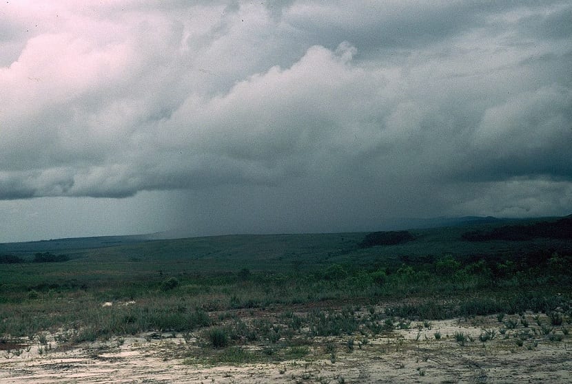
Storm
On the rain maps fronts are also shown that are formed when air masses, both cold and warm, meet and give rise to heavy rain. In the Northern Hemisphere, in an anticyclone, the wind turns following the isobars Clockwise and with a tendency to move away from the center. We have to remember that the wind will always move to the areas where there is less atmospheric pressure.
On the other hand, in a low pressure area, the wind is moving counterclockwise and heads towards the center of low pressures.
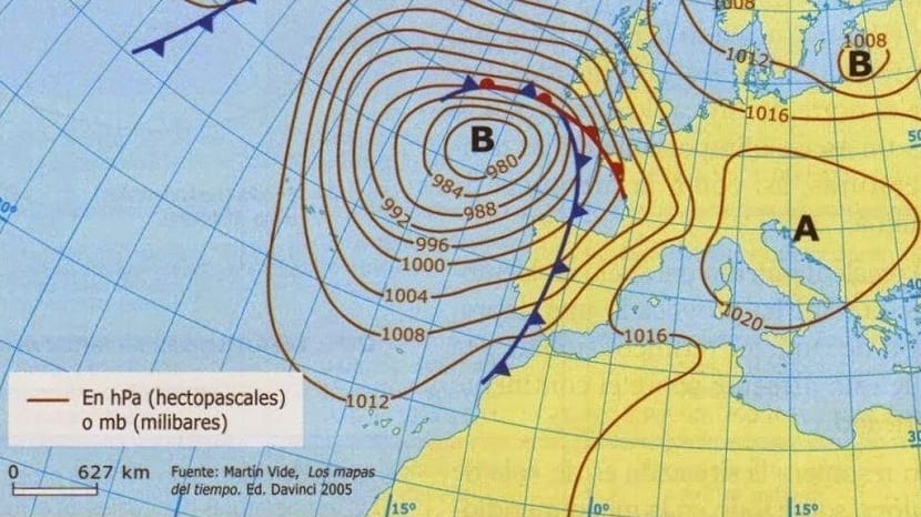
When you want to represent fronts in precipitation maps, isobars are used to indicate the direction and if the front is warm or cold. Cold fronts are represented by small triangles and warm ones by semicircles united to a line that covers the entire region that will occupy the front.

A front is nothing more than a large area of atmospheric instability where two air masses that are at different temperatures meet. If the cold air mass reaches an area where the temperature is higher, a cold front forms. When this happens, general temperatures drop and precipitation often occurs in the form of rain or snow. On the contrary, if the air mass reaches an area with a higher temperature, a warm front will form. In this case, cloudiness will also form, but the temperatures will be milder and the rainfall will be scarce.
Other precipitation maps

To get a good sense of the weather, meteorologists can not only look at isobar maps, but also look at other important meteorological variables. For example, other types of maps used are those of time in height, called isohipsas or geopotential maps. Isohipsas are lines that connect points that are located at the same height and that are at a certain level of atmospheric pressure. These lines are closely related to the temperature of the air in the layers of the atmosphere. At about 5.000 meters of altitude, the atmospheric pressure is 500 hPa.
As mentioned on other occasions, the warm air, being less dense it tends to rise. When this happens and in the higher layers of the atmosphere it encounters a very cold air mass, vertical air movements will occur that will cause instability situations in which there could be precipitation.

These situations of atmospheric instability occur when the map of isohipsas shows a trough or lower geopotential values. On the other hand, if the geopotential values are higher and the isohipsas form a ridge, It is a situation in which the air in height is at higher temperatures and, therefore, the meteorological situation is more stable and it would be unlikely that there would be precipitation.
NASA and the global rainfall map

In 2015, NASA released a global rainfall map that is updated every three hours and shows the entire rainfall pattern on a global scale and in real time. This rainfall map allows scientists to better understand how storms and winds are moving in all areas of the world.
Here is a small section of how the NASA rain map works:
As you can see, rain maps are a very important component in weather forecasting in meteorology.
Hello, good morning Germán Protillo, I found your contribution to the Rain Maps very important, my question is: In which variable is it more advisable to read the atmospheric pressure (hectopascals or millibars). Cheers
Hi, the measurement most used by meteorologists and physicists is that of millibars.
Thank you very much for your comment, greetings!