
El mekong river it is the longest in Southeast Asia, the seventh longest in Asia and the twelfth longest in the world. With a total length of about 4.350 kilometers, it grows in Qinghai Province, China, and flows through the eastern Tibet Autonomous Region and Yunnan Province. It is of great importance at the economic level.
Therefore, we are going to dedicate this article to tell you everything you need to know about the Mekong River and its characteristics.
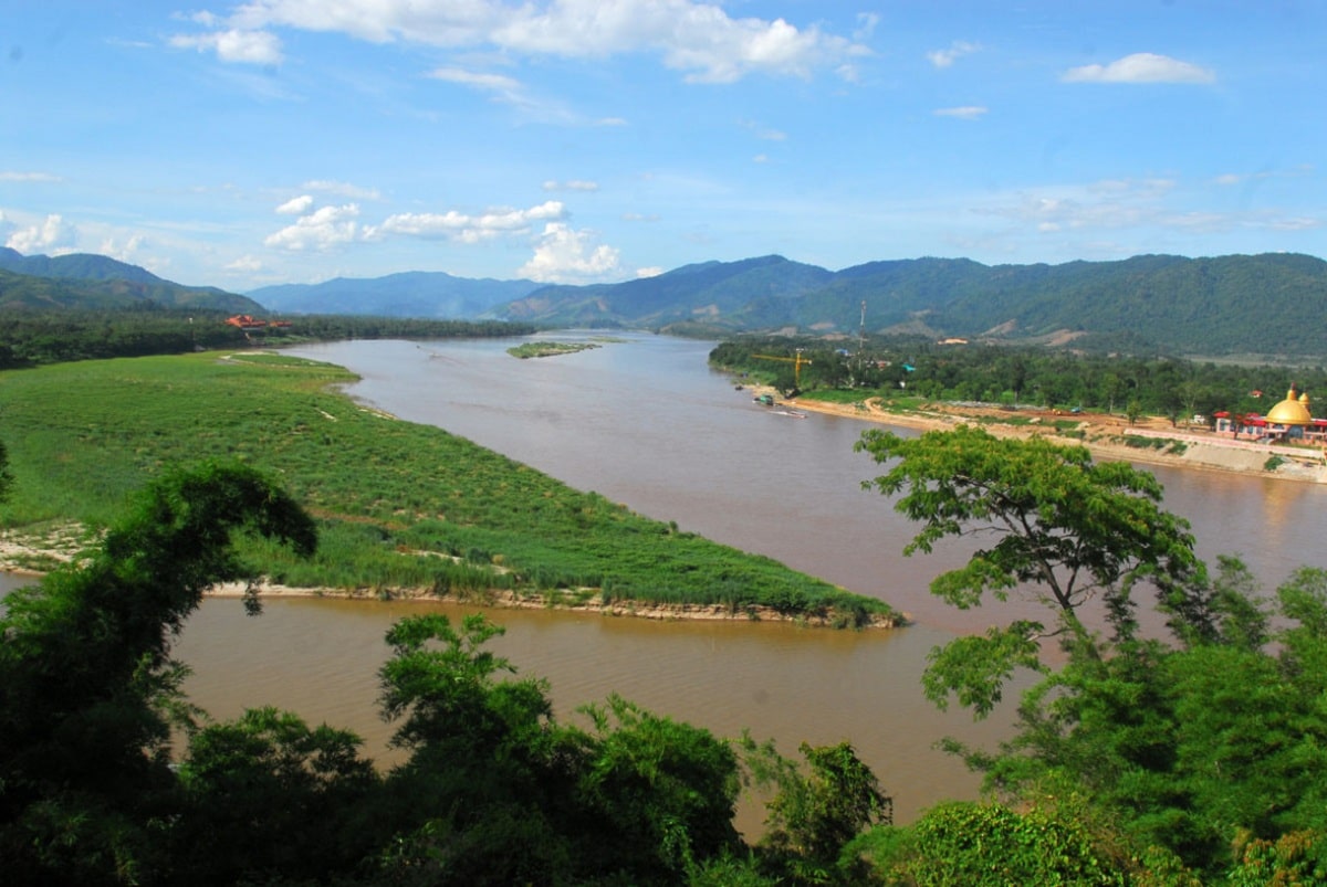
Key features
The Mekong River basin covers more than 313 square miles (810 square kilometers), and stretches from the Qinghai-Tibet Plateau to the South China Sea. Among Asian rivers, only the Yangtze and the Ganges have a higher minimum flow.
The Mekong falls from the Yunnan highlands, and the contrast between the physical conditions of its upper and lower reaches divides it into two main parts.
The Upper Mekong River flows 1.215 miles (1.955 kilometers) through a narrow valley, about a quarter of the total area, through mountains and plateaus in southwestern China (see article on the Kaola River). The lower Mekong, below the point where it forms the territorial border between Myanmar and Laos, is a 1485-mile (2390-kilometer) long river that it flows through the Korat Plateau in northeastern Thailand.
The western slopes of the An Nam Mountains in Laos and Vietnam, as well as Cambodia, then reach the sea via tributaries in the southern Vietnamese delta. Upstream, the Mekong rises from the Qinghai-Tibet Plateau between the Salween and the Yangtze; the riverbed cuts deep into the rugged landscape through which it flows.
Along the river between Myanmar and Laos, the Mekong River Basin covers some 8.000 square miles (21.000 square kilometers) of Myanmar's territory, including relatively inaccessible and rugged terrain. In the gentler lower reaches, the Mekong forms the border between Laos and Thailand for considerable distances, inspiring conflict and cooperation between Cambodia, Laos, Thailand, and Vietnam.
Mekong River Climate

The Mekong's flow comes mainly from rainfall in its downstream basin., which fluctuates seasonally with the monsoons. In April, traffic is usually less. In May or June, when the rainy southern monsoon arrives, the flow begins to increase, especially in the eastern and northern highlands.
The highest water levels in the Mekong occur upstream in August or September, and in the south until October. The northeast monsoon usually begins in November in the southern regions, bringing dry weather into May. During long dry spells, rice cannot be grown without irrigation, and river water is vital for agriculture. Temperatures in the lower Mekong basin are uniformly warm throughout the year.
Phnom Penh daily highs average 89°F (32°C) and lows average 74°F (23°C). In the upper part of the basin, temperatures are moderated to some extent by elevation, are generally cooler than in the south, and show greater seasonal variation.
Mekong River Pollution

Experts have warned that the country's breadbasket, the Mekong Delta, is now at high risk of freshwater shortages as water levels have fallen to their lowest levels in 100 years. In 2015, the water levels in the area dropped dramatically by 15 meters, according to the Vietnam Society of Geology and Hydrology.
In the past, people needed to dig wells as deep as 100 meters to get fresh water. Today, even if you dig to a depth of 200 meters, you are not sure if the water is usable because much of it is contaminated with salt and chemicals. Meanwhile, a report from the Ministry of Natural Resources and Environment (MONRE) shows that current flows in the upper Mekong have slowed, causing saltwater intrusion two months earlier than usual in 2016.
Saltwater intrusion was reported in 11 of the 13 Mekong Delta provinces and municipalities. An estimated 210.000 hectares of crops have been damaged since the end of 2015. Around 250.000 homes and 1,3 million people lack water on a daily basis. Meanwhile, Professor Stefanola, a groundwater expert from Germany, has warned that water in the Mekong Delta could be contaminated with arsenic.
The expert, who has conducted scientific research on solutions for sustainable groundwater use in Southeast Asia, said arsenic concentrations in Southeast Asian groundwater are above safe levels (10 mg/l) in many places.
Arsenic has serious consequences for human health, he said, urging scientists to find out the concentration of arsenic in the waters of the Mekong Delta as soon as possible. The warning came a few days ago at a seminar on technical solutions for the management and use of water, energy and land in the Mekong Delta, organized by the Can Tho city authorities of the German Ministry of Education and Research.
Economy
In downstream watersheds, flood protection and water resource management provide important opportunities to increase economic productivity.
Farmers practicing crop rotation in the uplands and rice farmers in the rainfed lowlands they can only produce one crop a year under normal circumstances, taking advantage of the rainfall of the rainy season.
Half of the arable land depends in some way on flooding. Controlling it, however, allows this water to be stored and used during the dry season to produce second or third crops. Additionally, irrigation combined with flood protection improves arable land by reducing losses and delays caused by flooding on river banks. They have been developed small hydroelectric facilities in places with better water storage facilities and downward slopes.
Much of this development work was carried out under the auspices of the Interim Committee for the Coordination of Research in the Lower Mekong Basin (Mekong River Commission), which was organized in 1957 by Cambodia, Laos, Thailand and South Vietnam. South. After 1975, Vietnam replaced South Vietnam on the committee and Cambodia no longer participates, but Cambodia has returned to membership since 1991. The committee has sponsored various pre-investment and general scientific investigations and undertook construction of various water projects.
I hope that with this information you can learn more about the Mekong River and its characteristics.