
Throughout our planet there are numerous places with great charm. These fantastic places are tourist destinations and have incalculable beauty. Among these places we have the leeward islands. These islands belong to the Lesser Antilles. It is a group of islands that are distributed between the Netherlands and Venezuela.
In this article we are going to tell you what the Leeward Islands are and what their characteristics are.
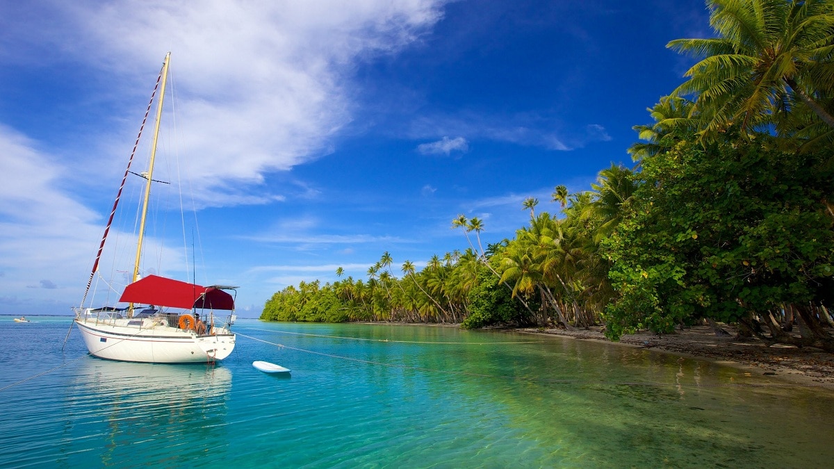
Leeward Islands
The Leeward Islands are a group of islands belonging to the Netherlands and Venezuela, which are also located off the Venezuelan coast, at the easternmost point of Puerto Rico. As for Venezuela, we must consider that Venezuela is not only composed of its terrestrial theory, but also has influence in the Caribbean Sea, is the owner and sovereign of the 89 islands of Venezuela. For this, there are federal territories of Venezuela.
The federal territories of Venezuela include all the theories that are not included between the Venezuelan federal entity and the capital region, as well as the islands formed in the territorial waters of Venezuela.
Respecting the appropriate regulations of the Caribbean, Venezuela can use the islands in its territorial waters for entertainment, finance, sports and many other activities, as long as it does not violate international restrictions or laws.
Venezuela knows how to mark maritime territorial lines along with five other countries that also have islands in the Caribbean, these countries are the following: United States of America, France, the Netherlands, the Dominican Republic and Trinidad and Tobago.
Characteristics of the Leeward Islands
These islands belonging to the Venezuelan oceanic territory and belonging to the Leeward group of islands usually feel the following temperatures: 26 and 28º C, that will be its annual averages, and approximately 300 and 500 millimeters of precipitation per year. According to a census conducted in 2015, the total population of these islands entering Venezuelan waters is only 6.500, which is an uninhabited area in the theory of Venezuela.
After Spain recognized Venezuela as a free sovereign country, the country controlled the islands in the southeastern Caribbean Sea and enacted a law of territorial and political division in 1856, where the province of Margarita was established, which is now known as Margarita.
For many years many presidents wanted to classify the islands belonging to the Venezuelan country and ignored other islands. However, later presidents realized that these excluded islands are also part of the national maritime territory. These islands are: Isla Pájaro, Isla Coch and Margarita Isla.
During their tenure, Joaquín Crespo, Cipriano Castro and others have realized that these islands are indeed Venezuelan maritime territories and have taken the necessary measures, therefore, they are recognized as part of Venezuela.
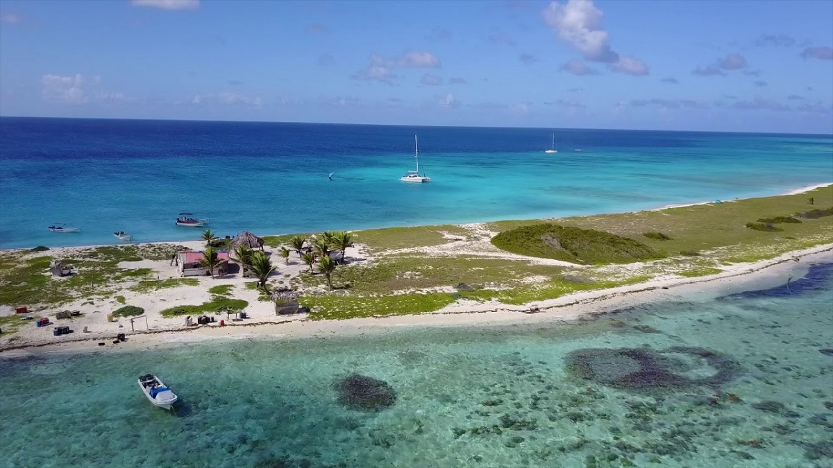
Archipelago The Witnesses
The Archipelago Los Testigos is a group of islands belonging to Sotavento Island and also a federal territory of Venezuela, therefore it is under the control and supervision of the Venezuelan government authorities.
It is located in the northeast of Margarita Island, according to the 2001 census its population is 197 inhabitants, most of which are from Margarita Island and are related to each other. These islands can be reached by boat and motorboat. It consists of a total of 8 islands, with a general area of approximately 6,53 square kilometers. The group of islands that belong to the Archipelago Los Testigos are the following:
- Big Witness Island: It is the largest in the archipelago.
- Rabbit Island: It is the second largest in the archipelago.
- Iguanas: It is located to the southwest of the archipelago and is the third largest of the same.
- Morro Blanco Island: It is the southern island of all and is uninhabited.
- Northeast Island: It is located northeast of the main island and is the most isolated of all.
- gust: It is located to the east of the main island and has a fairly pronounced division in the hill that forms it, which gives rise to its peculiar name.
- The goat: Located east of Isla Iguana.
- Rock of Outside: It is one of the smallest islets or rocks of the archipelago.
Some history
In the past, these islands were important political and religious centers, and from here other islands of Polynesia were colonized. The great chieftains of Tahiti have their roots in these islands. Raiatea is a religious center with a temple that refers to other islands. Bora Bora has a very militant population and enormous political influence.
The first European to visit them was the Dutchman Jacob Roggeveen in 1722. But the British James Cook explored the larger islands several times between 1769 and 1779 and called them the Society Islands. He explained that the name was due to the islands being continuous, but someone explained that it was to commemorate the Royal Society of London that funded the expedition. Later the name spread throughout the archipelago.
After France established a colony on the Windy Islands in 1880, the Leeward Islands refused to integrate and were jealous of their independence. Between 1889 and 1897 there was a long insurrectionary situation in the so-called Leeward Island War.
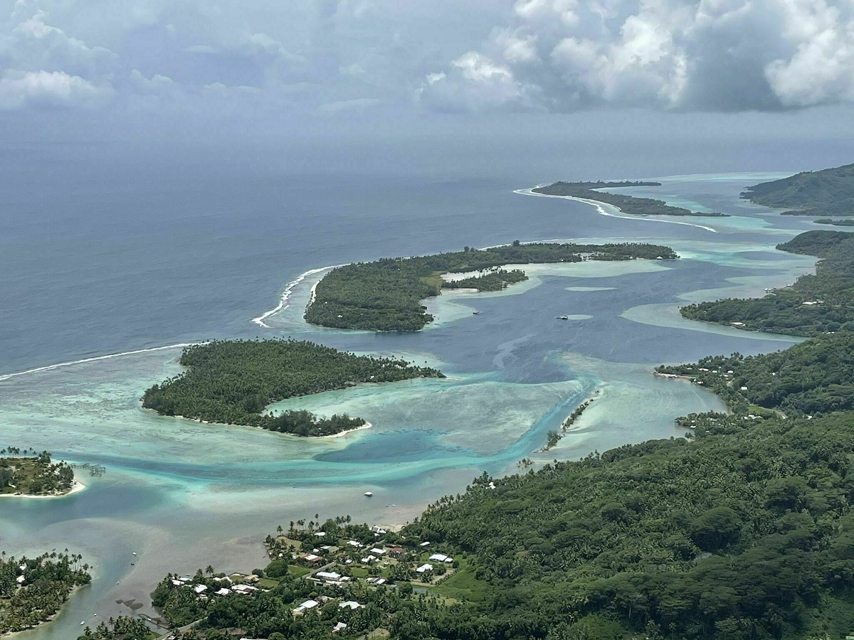
Geography of the Leeward Islands
The archipelago consists of five islands and four atolls organized into seven communes. From east to west they are:
- Huahine, constituted as a commune.
- Raiatea, divided into 3 communes, with Uturoa as the capital.
- Tahaa, constituted as a commune.
- Bora Bora, constituted as a commune.
- Tupai, Bora Bora dependent atoll.
- Maupiti, constituted as a commune.
- Maupihaa, Maupiti dependent atoll.
- Motu One, an atoll dependent on the territorial administration.
- Manuae, an atoll dependent on the territorial administration.
Except for the smallest atolls, these islands are all mountainous volcanoes. They are made of trachyte, diabase, and basalt. The volcano has been dormant for a long time and the crater has been severely eroded, forming deep valleys. They are surrounded by coral reefs, which close off the saltwater lake and protect the fertile shoreline.. The total area of the land unearthed is almost 400 square kilometers.
The vegetation includes breadfruit, vanilla and coconut trees. Land animals are limited to wild boars, rats, and newts. On the contrary, fishing activities on coral reefs are rich and varied.
I hope that with this information you can learn more about the leeward islands and their characteristics.