
In order to study our planet, in detail there is a branch of science known by the name of geodesy. It is the science that studies the shape of the Earth's dimensions. This includes the determination of the external gravitational field of the earth and the surface of the ocean floor. Within geodesy a concept is frequently used which is the geodesic point. It is a construction of earth that serves to be able to accurately reference the geographical position of a place. They work by triangulation of vertices and a national and regional topographic map of the geodetic points can be constructed.
In this article we are going to tell you all the characteristics, function and utility of the geodetic point.
Key features
As we have mentioned before, geodesy studies the shape and dimensions of our planet. Thanks to this science we can also determine the external gravitational field and the surface of the ocean floor. The definition of geodesy also includes the study of the imposition orientation of our planet in space. A fundamental part of geodesy is determining the position of points on the earth's surface through the use of coordinates. Thanks to these coordinates we can have the latitude, longitude and height values.
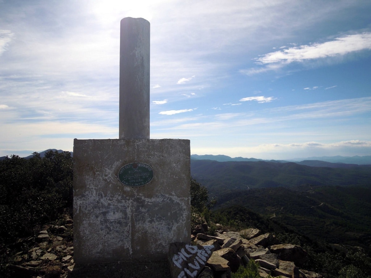
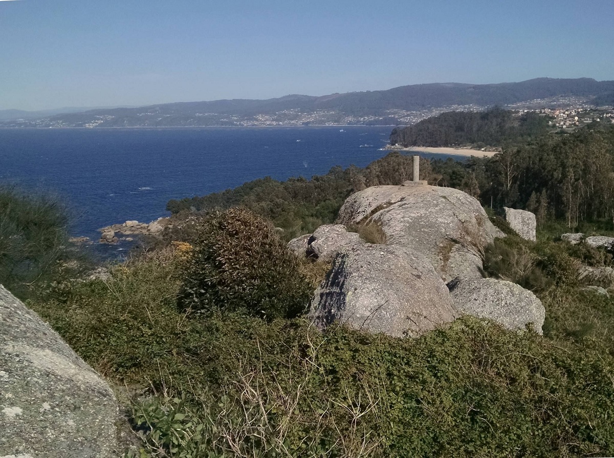
The materialization of all these points on the ground constitute geodetic networks. These networks are made up of a series of points known as a geodetic point. These points have coordinates that form the base of the cartography of a country. You could say that they are the infrastructure of the infrastructures. The geodesic point is nothing more than a stone construction that helps us to reference the exact geographical position of a place. Once they are in place, the vertex triangulation method is used to build topographic maps at a regional and national scale.
In Spain there are more than 11.000 geodetic points distributed and all of them are maintained by the National Geographic Institute. All these vertices are part of the National National Geodetic Network and have constituted the practical materialization of the European Datum 1950 (ED50) Geodetic Reference System. The network is organized into two groups:
- First Order Network (RPO): it has about 680 vertices and a length of more or less 30-40 kilometers between each of them.
- Lower Order Network (ROI): This bird has about 11.000 vertices and an average length of about 7 kilometers between each of them. It can be said that there is one geodetic point for every 45 square kilometers.
Geodesic point and geodesy
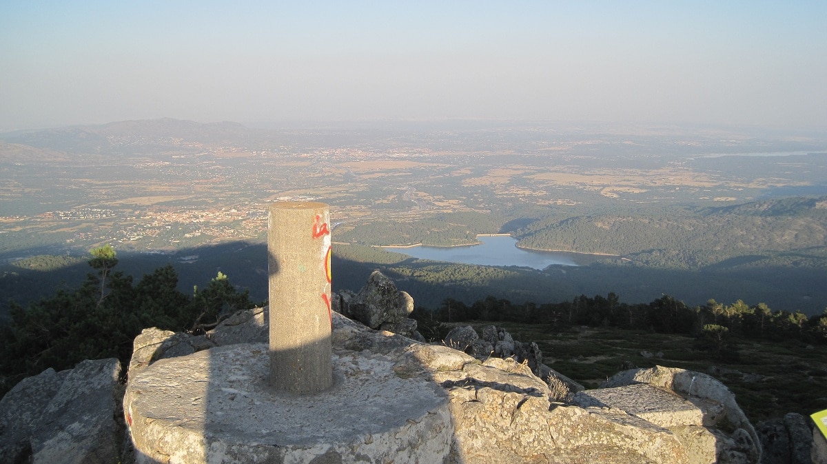
The geodetic vertices of the RPO are composed of a cylindrical pillar about 120 centimeters high and about 40 centimeters in diameter. The base on which they are built has a surface of 3 square meters of concrete. On the other hand, those that belong to the ROI are composed of a pillar 120 meters high and 30 centimeters in diameter. They are located on a base of one square meter of concrete. In addition, they have information about your protection and about the coordinates of your position.
The physical and mathematical foundations that are necessary to obtain these data make geodesy a fairly basic science for other disciplines. Topography, cartography, navigation, civil engineering, photogrammetry, geographic information system and some other military purposes are fed from geodesy. If we analyze all this from the point of view of the object of study we see that a division can be established in different specialties that geodesy is responsible for.
Types of geodesy
Today, almost any job that had to do with this discipline requires the intervention of several of these subdivisions. Let's see what are the classifications and variants of geodesy:
- Geometric geodesy: is responsible for determining the shape of the dimensions of planet Earth in its most geometric aspect. This includes determining the coordinates of points on the earth's surface.
- Physical geodesy: is responsible for studying the Earth's gravitational field and all the variations that occur. It is also in charge of studying both oceanic and terrestrial tides and the relationship with the concept of altitude.
- Geodesic astronomy: It is in charge of determining the coordinates of the earth's surface where measurements of the stars can be made.
- Spatial geodesy: determines the position of the coordinates from measurements made on artificial satellites and other natural or artificial objects that are located outside our planet.
- Microgeodesy: This is the variant that is responsible for measuring deformations of civil works structures or small areas of land. These deformations are measured by high precision geodetic techniques.
Importance of the geodetic point
When we look at the figure of the Earth and exclude the topography or external shape, we see that it resembles the definition of geoid. A geoid is nothing more than an equipotential level surface of the Earth's gravitational field. The importance of the geodetic point lies in the formation of the network of permanent stations. The objectives of this network that has been developed since 1998 by the Geodesy Area of the National Geographic Institute are the following:
- Obtain all coordinates with a high degree of precision and velocity fields in almost all points of the network.
- Contribute to the definition of the new Global Reference Systems in the national territory.
- Use the data obtained to make records. These records will be used in other studies in the field of geodynamics, troposphere, ionosphere, meteorology, etc.
- A fundamental network can be defined to support real-time applications.
- Provides data for geodetic, topographic, cartographic and positioning jobs.
Thanks to the distribution network of these points, topographic maps can be made at the regional and national level. Although at first glance they only look like pieces of concrete without any value, when you go hiking and get to a high area you will see a geodesic point.
I hope that with this information you can learn more about the geodetic point and its characteristics.