
There are a great variety of types of clouds in the sky, but today we are going to talk about one that is common in our skies: the cirrus cloud.
Do you want to know why they appear and what time signal they indicate?
Appearance of a cirrus cloud
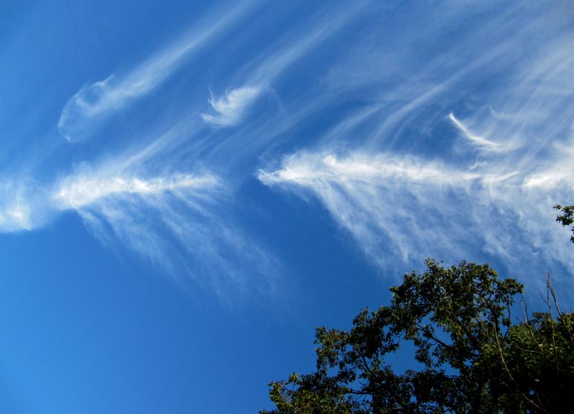
The cirrus or cirrus are a type of cloud that is composed of ice crystals, since they are formed at a height of about 8.000 meters. It is characterized by having thin, thin bands and is shaped like a horsetail at the end. Sometimes a cirrus cloud is added to another and it seems so long that it is not possible to distinguish which one is from the other. When this occurs, they are called cirrostratus.
The name of cirrus derives from Latin cirrus y means curl. Hence, it refers to the shape of the cloud.
Cirrus clouds indicate the difference in air movement between the top and bottom of the cloud. Since the wind direction can change, cirrus boundaries can move rapidly above the air layer and break into a lower and faster air layer.
They usually appear at heights between 8 and 12 km. Ice crystals that fall when the cloud dissolves evaporate before falling to the ground.
That there are cirrus in the sky can indicate that there is a frontal system or a disturbance of the upper layers. They can also indicate that a storm is coming. Normally, large layers of cirrus clouds are the ones that accompany high-altitude air flows.
Cirrus and climate change
Cirrus work by trapping the heat emitted by the Earth back into space during the greenhouse effect, but they also help to reflect the sunlight from reaching the surface. It is not well known how it clearly affects the energy balance of the Earth, but they are known to contribute to terrestrial albedo.
This aspect is important to take into account when predicting climate change.
You already know something more about the clouds in the sky.