
El Silver river, is a declining Atlantic invasion of the east coast of South America, between Uruguay in the north and Argentina in the south. It is generally considered the mouth of the Paraná and Uruguay rivers, although some geographers consider it the marginal sea of a gulf or the Atlantic Ocean and others consider it a river. It has great importance both economically and in terms of flora and fauna.
For this reason, we are going to dedicate this article to telling you everything you need to know about the Río de la Plata and its characteristics.
Key features
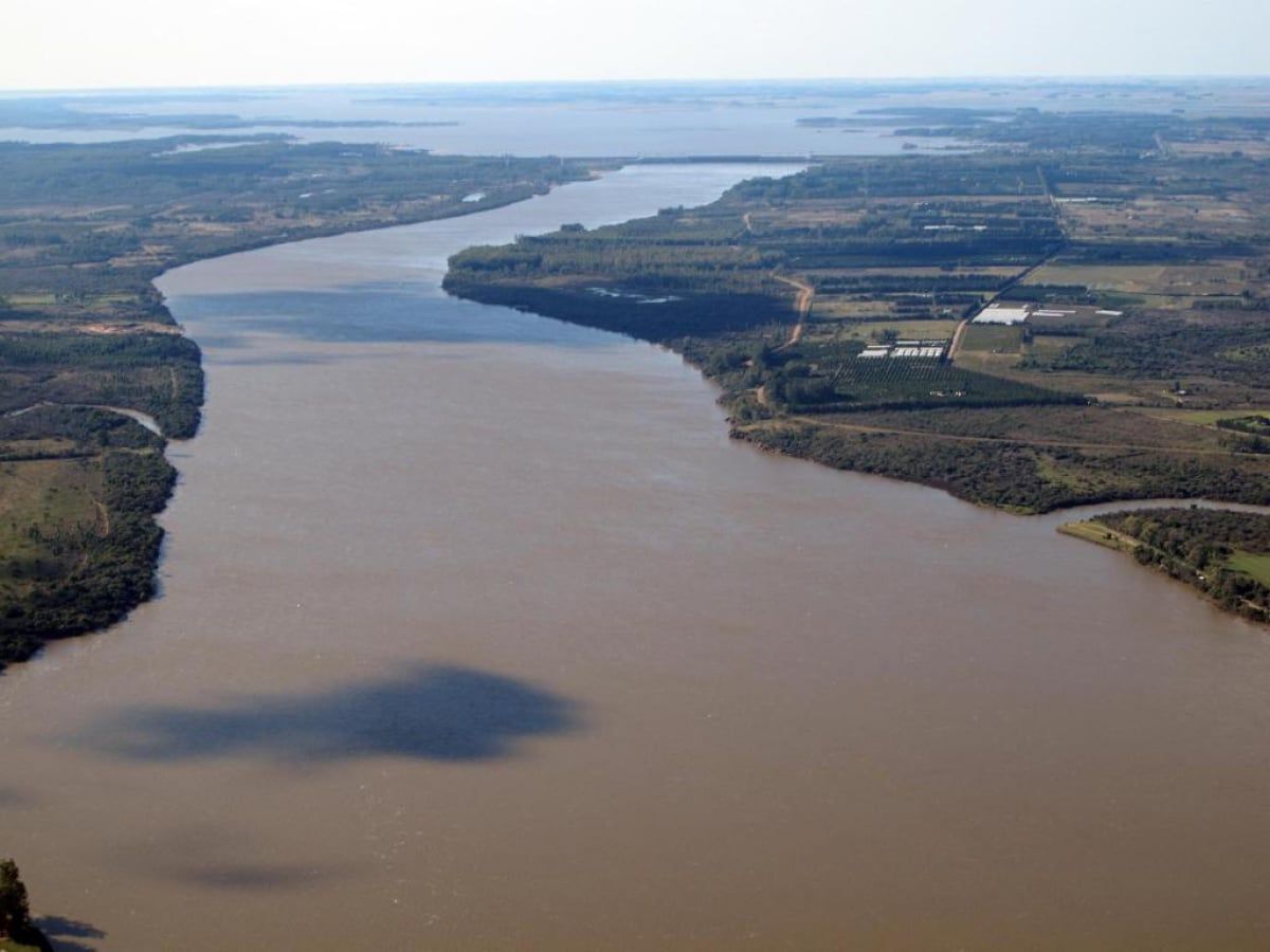
The Río de la Plata is like an estuary where fresh water and salt water mix. Its fresh water comes from one of the longest rivers in the world, the Paraná and its main tributary, the Paraguay, as well as the Uruguay and other smaller streams.
The Río de la Plata receives water from the basins of the Paraguay and Paraná rivers, which cover a large part of central-southern South America; the drainage area totals about 1,2 million square miles (3,2 million square kilometers), roughly most of the continent's land area.
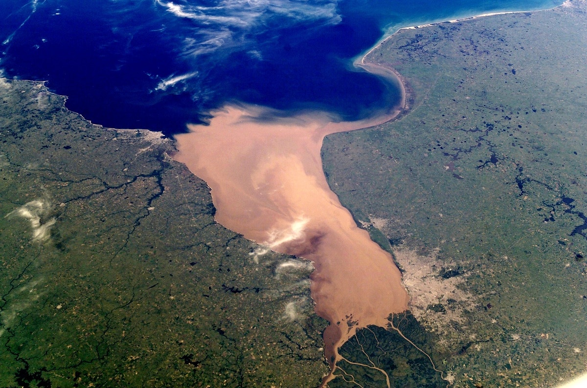
The Paraná Delta and the mouth of the Uruguay River are located upstream of the Río de la Plata. The width of the estuary gradually increases from the headwaters to the sea. La Plata is more than a river, it is the largest river in the world with a total area of about 13.500 square kilometers.
The submerged shoals of the Barra del Indio act as a barrier dividing the Río de la Plata into an inner freshwater river zone and an outer brackish estuary zone. The bank is approximately halfway between Montevideo and Ponta Piedras. It is the fresh water of the interior that many people describe as a river.
The upper reaches contain several islands, including the islands of Oyavid and Solís in Argentine waters, and Juncal, Elmaton, Martín García and Timo Domínguez in Uruguayan waters. The Plata islands tend to grow over time due to the deposition of sediments caused by the high current loads brought by the river's tributaries.
Hydrology of the River Plate

The speed of the Paraná current changes frequently in the long course of the. For the Alto Paraná, when the river bed widens (especially when a true lake forms, as in the Itaipu dam), the velocity decreases, and where the river bed narrows (as in the Itaipu canyons downstream ) will be much faster.
Further down, he slowed down on his way to Posadas, but then sped through a series of rapids and runs. He slowed down the Corrientes again, stabilizing its flow at an average of 2,5 miles per hour on its way to the Río de la Plata.
The entire basin of the Paraguay River covers more than 380 square miles and rarely rises above 000 feet above sea level. As a result, the river's slope varies very little over long distances, about 1,2 to 1,6 centimeters per kilometer.
Several streams in the watershed have low levees, or natural levees, which form when slow-flowing parts of the river are deposited during periods of flooding. When the river receded, its banks remained above the water level of the adjacent plain. During a flood, a continuous water table, often up to 15 miles wide, lies below the floodplain, submerging a surface area of approximately 38,600 square miles.
The Paraguay River has variable flows between its source and its confluence with the Paraná River. Above Corumbá in Brazil, it has a typical tropical zone with its highest point in February and its lowest in July-August. Below Corumbá, the highest point occurs in July and the lowest point occurs in December-January.
Pollution of the River Plate
Pollution from urban and agricultural areas has led some to label the Río de la Plata and its small tributaries as the "worst environmental pollution" in Argentina. It is common for garbage and sewage to float in the river. Although the Supreme Court of Argentina requested in 2008 an official plan to clear the river bed, little action was taken.
For example, in 2008 there were 141 open-air dumps with industrial, chemical, and domestic waste along the Matanza tributary from west of Buenos Aires to the Río de la Plata.
According to the cleanup plan, the landfill was supposed to close in 2010, but another 207 dumps were reported, bringing the total to 348. In addition to garbage and chemical loads from the cities, increased fertilization of farmland along the river also increased microcystins and moderate eutrophication.
Flora and fauna
Plant life in the vast Río de la Plata region is highly diverse. In the east, in the upper Paraná basin and at higher elevations, there are forests with valuable evergreen trees such as the paraná pine for the cork oak.
The western region is mainly grassland for cattle grazing. In the flooded areas, there are beautiful water hyacinths, Amazon water lilies, trumpet trees, and guamas that thrive in the wetlands.
Palm trees such as muriti and carandá grow along the rivers and streams, as well as several quebracho trees that are believed to be the source of tannins. In the Gran Chaco region of western Paraguay, where the land is used primarily for cattle, there are patches of arboreal shrubs and herbaceous savannahs, as well as drought-tolerant thorny shrubs.
The River Plate in Argentina It is home to the rare La Plata dolphin and several species of sea turtles:
- Caretta caretta.
- Chelonia mydas.
- Dermochelys coriacea.
It is rich in animal life, including some unique species. Silver dolphins can be found throughout the estuary and along the Atlantic coast, as can whales.
I hope that with this information you can learn more about the Río de la Plata and its characteristics.
THEY ARE EXCELLENT RIVERS – IT IS NECESSARY TO STRENGTHEN THEIR SHORES – MAINTAIN THE DREDGING – CLEANING WITH GARBAGE FILTERS, MAINLY PLASTIC – DO NOT SPILL TOXIC LIQUIDS – TAKE CARE OF THEIR WILDLIFE AND AVOID NETS FOR COMMERCIAL PURPOSES, MAINLY FISH MEAL. YEARS 50 GOOD FISHING, OUTSTANDING PARANÁ MINÍ ISLAND OF MY FATHER AND LADY. I WOULD LEAVE THE CLUB SAN FERNANSDO ROARING AND WITH MY BROTHER WE Drank WATER FROM THE MIDDLE OF LUJÁN AND WITHOUT SILTRATING. THANK YOU HUG RICARDO