
As the planet warms and the human population increases, it is becoming easier on the planet to see the changes that are taking place. Fires that accompany intense and prolonged droughts, lakes and seas that dry up, meteorological phenomena such as hurricanes or increasingly devastating tornadoes ...
But many times we think that these are just words; that do not have to affect us. However, thinking that is wrong, because we all live on the same globe, and all, sooner or later, will see the effects of global warming in our area. Meanwhile, we leave you with six photos taken by NASA that show the stark reality.
Arctic
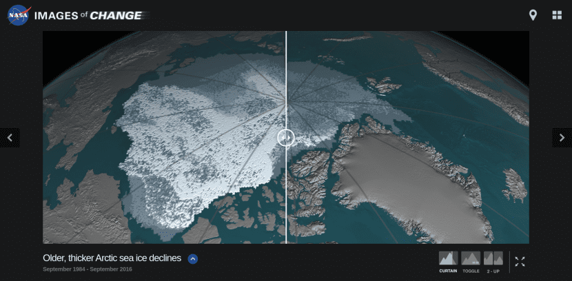
Image - NASA
In this image you can see that the area covered by the young ice, that is to say, of recent appearance, has decreased from 1.860.000km2 in September 1984, to 110.000km2 in September 2016. This type of ice is very vulnerable to global warming as it is thinner and melts more easily and quickly.
Greenland
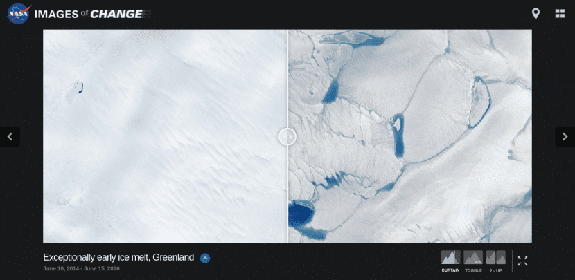
Image - NASA
In the specific case of Greenland, it is normal that each spring or early summer streams, rivers and lakes form on the surface of the ice sheet. However, the melting of the ice began very early in 2016, which indicates that the thaw in this part of the world is beginning to be a problem, and serious.
Colorado (United States)
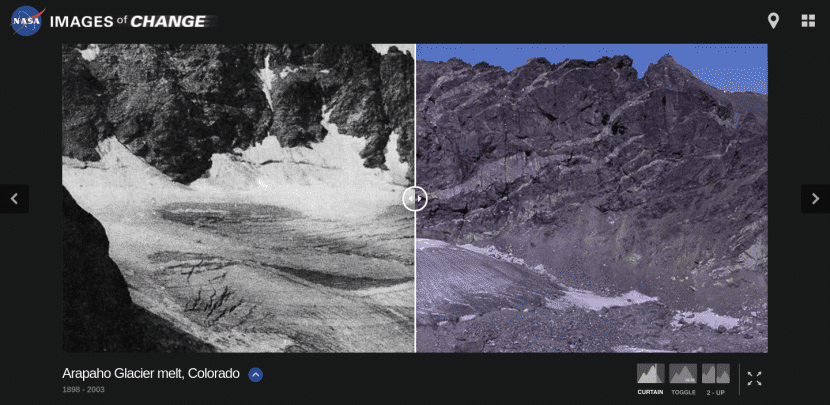
Image - NASA
Since 1898, the Arapaho Glacier in Colorado has shrunk by at least 40 meters according to scientists.
Lake Poopó, in Bolivia
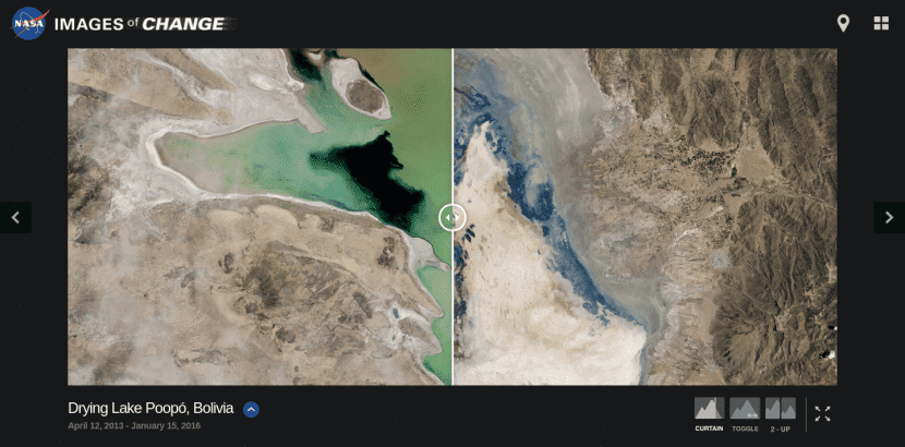
Image - NASA
Lake Poopó, in Bolivia, is one of the lakes most exploited by humans, which has used its waters for irrigation. Drought is also one of his problems, so he does not know if he will be able to recover.
Aral Sea, Central Asia

Image - NASA
The Aral Sea, once the fourth largest lake in the world, is now… nothing. A desert area where there used to be water that was used to irrigate cotton and other crops.
Lake Powell, in the United States

Image - NASA
The intense and prolonged drought in Arizona and Utah (United States), as well as water withdrawals, have caused a dramatic drop in the water level of this lake. In May 2014 the lake was at 42% of its capacity.
If you want to see these and other images, Click here.