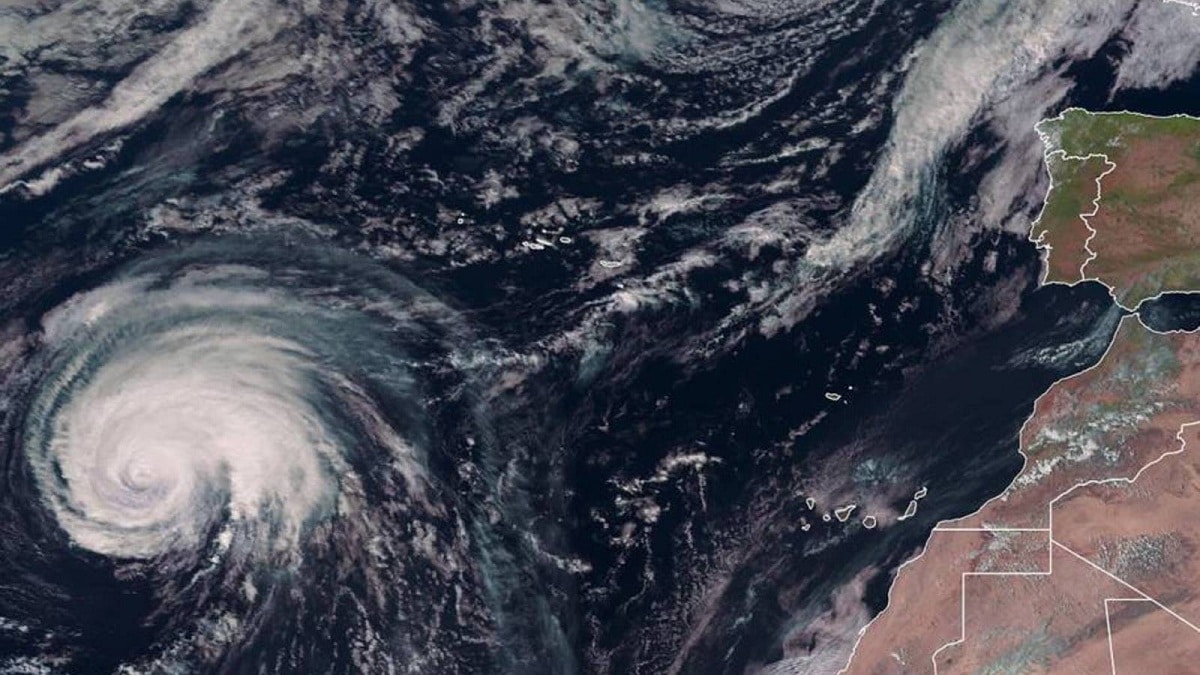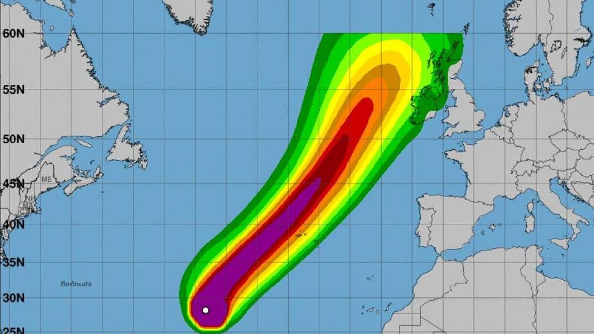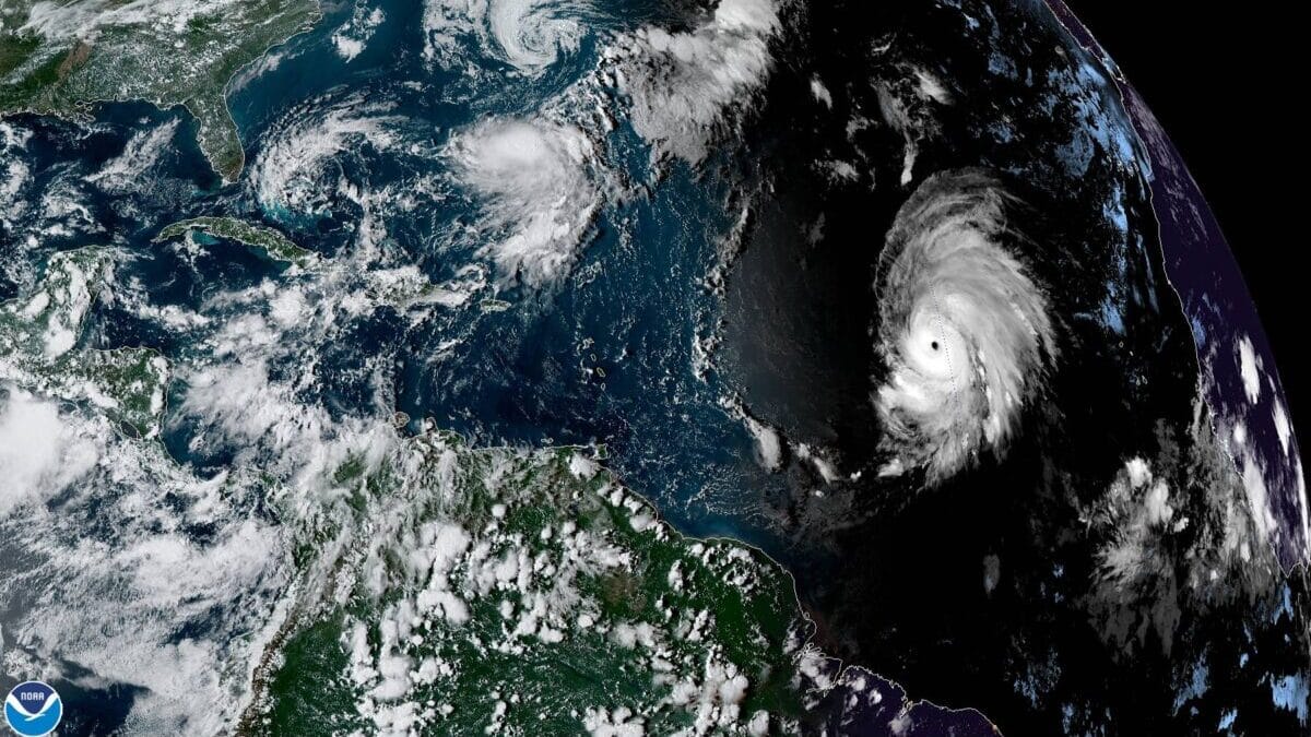
El Hurricane Lorenzo took place in September 2019 and was located at 45 degrees west longitude. It came to affect the westernmost coasts of Europe in a route that ended in the northern tip of the British Isles. It was a most striking hurricane to see that it is one of the first such phenomena in this part of the world. It is the most powerful hurricane to appear near Spain for as long as we have records.
For this reason, we are going to dedicate this article to summarize all the characteristics of Hurricane Lorenzo and if we are going to see it again, this will happen in the future.
Climate change and hurricanes

We know that the consequences of climate change are an increase in the frequency and intensity of extreme weather events such as droughts and floods. In this case, what mainly affects the generation of hurricanes has to do with rising global average temperatures. Keep in mind that the dynamics of the formation of a hurricane has to do with the amount of water that evaporates into the atmosphere and the contrast between the waters of different oceans. This means that in the areas where the greatest amount of water evaporates, intense rains end up since all this water ends up condensing and forming torrential rain clouds.
With the increase in global average temperatures, we are going to have a change in the dynamics of the atmosphere. Places where it was colder before, will be hotter and, therefore, we will have a higher evaporation rate. Hurricane Lorenzo headed for Europe and, as it moved northeast, it gained strength to become a Category 5 hurricane. This is the highest category on the Saffir-Simpson scale. It was compared to the devastating hurricane Katrina that swept through New Orleans in 2005..
Hurricane Lorenzo Characteristics

It is not only compared to Hurricane Katrina in terms of intensity, but also in the area in which it strikes. This very particular phenomenon in this area of the Atlantic is the first time it has been recorded. According to all the measurements of institutions and experts, the path of Hurricane Lorenzo made the impact on the continent somewhat lighter, and the biggest problem was in the Azores. He arrived in this area as winds of 160 km / h and gusts of more than 200, in some points. By the time it reached the British Isles it was already so weakened that it was not considered a hurricane.
When a hurricane is generated in the ocean, it feeds on the water that evaporates and reaches its maximum when it reaches the coasts. However, once it enters the continent, it weakens and loses strength as it enters. This makes hurricanes more feared in coastal areas than in inland areas. The further inland an area is, the more it is saved from hurricanes.
Hurricane Lorenzo in the area of Spain

It is very rare to see a hurricane in a place like ours. The first answer given to this type of doubt is quite clear. The most striking thing is the trajectory and category of this hurricane, but hurricanes begin their formation in Africa. It is here where waves of disturbance are generated that cause instability and that is dragged. When these instabilities reach the warmest sea in the Caribbean, they become the classic and powerful hurricanes that we usually see.
The thing that this time has not reached the Caribbean since has encountered waters warm enough to form the hurricane. Instead of going west it has gone east. As we have mentioned before, for the hurricane to form, it only takes quality water that makes a large amount of water vapor elaborate that, finally, is compensated at altitude. This is how hurricane clouds form.
It only had to go towards 45 degrees west longitude for Hurricane Lorenzo to form. It is true that as an unusual trajectory for what we are used to, but while going north, category 5 was taken. The most interesting thing about this phenomenon is that it has gone on an unusual trajectory and, although it has gone through normally less warm waters, it managed to take enough energy to reach the maximum category of hurricanes.
These are the reasons why Hurricane Lorenzo became one of the most famous hurricanes of our time. As for the birth of the hurricane, we see that it has to do with climate change, as we have mentioned before. It is true that it has had to find warmer waters than normal to be able to reach category 5, but In any case, the existence of this type of hurricane cannot be directly related to climate change. We need a lot of attribution studies and more similar cases to be able to ensure something like this. It must be taken into account that climate change is having long-term repercussions and that there is still not enough evidence to be able to link the effects of climate change to the formation of Hurricane Lorenzo.
Will it happen again?
The doubt of many people is if we will see a hurricane of this category in our area again. Meteorology in Spain explains that with climate change we need to have various studies and more similar phenomena to know if there is some type of pattern or there are changes in the behavior of hurricanes. A curiosity is mentioned in the studies and that is, we have to see if similar hurricanes come to us in the coming years to be able to talk about this pattern. The year before we had Leslie who had a similar behavior to Lorenzo. With this, the have doubts about the effect of climate change on the pattern of hurricane formation.
Hurricane Leslie affected our country and was the most powerful cyclone to reach the Iberian Peninsula since 1842. It was also considered one of the longest lasting Atlantic hurricanes in time. It also had an extremely weird behavior since it had continuous changes in its trajectory. This caused that the experts could not plot a course well.
I hope that with this information you can learn more about Hurricane Lorenzo and its characteristics.