We have always interpreted the wind as a movement of air from one area to another and that we cannot see it unless it carries sand or materials. The curiosity of people in the wind arises in how something that we cannot see can be measured.
How do they measure the wind and what types of wind are there? What do experts use to refer to moving air by different names?
Why does the wind form?
There are several ways in which the wind can be produced. Normally, the most frequent is that there are two points in different areas where it is established between them a difference in pressures or temperatures. When it is the case that there are two points where the pressure varies, the air masses will tend to move from where there is more pressure to where there is less. Like when we take a tube of toothpaste, we press to make the toothpaste come out creating a pressure difference. Pasta tends to flow from where there is more pressure to where there is less. This pressure difference is called by meteorologists gradient.
Because there is a closely linked relationship between wind and pressure, they are made isobar maps. These isobar maps are the ones that represent the pressure differences that in turn give information about the speed and direction of the wind. The isobars are the lines with equal pressure. So on a map where the isobars are very close together, it will tell us that it is windier, because in a short space, the pressure changes a lot.
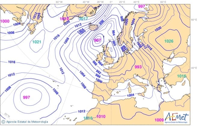
Source: http://sarablogcen.blogspot.com.es/2012/11/mapa-de-isobaras.html
In the case in which the wind is formed by temperature difference, something else happens. When an air mass acquires a temperature higher than that of its surroundings, its volume increases, which reduces its density. Due to the effect of flotation, the hot air mass will rise, and its place will be occupied by other air masses, in their displacement they will cause the wind. This movement of hot and cold air masses is in turn the origin of many summer storms and, on a larger scale, of the winds that predominate in the areas of the tropics of the tropics.

Source: https://okdiario.com/curiosidades/2016/11/22/como-produce-viento-546373
How is the wind measured?
Wind can be measured in different ways and in different units. The most used are:
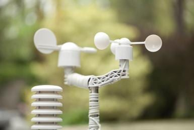
- Measurement of horizontal wind speed: the most used instrument is the anemometer of cups, in which the rotation of the same is proportional to the speed of the wind. The unit of measurement is km / h or m / s.
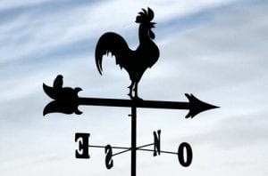
- Direction measurement: for this they are used the weather vanes, which indicate the geographical origin of the wind. We speak of north, northeast, southwest wind, etc. depending on where it comes from.
Some special types of wind
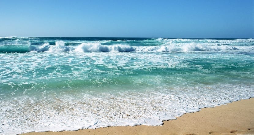
Sea breezes
Surely some hot beach day you have felt a pleasant sea breeze as you approach the shore. Its origin is as follows: During the day, the land heats up faster than the surface of the sea, so that the interior air rises and is taken up by cooler air from the sea. At night, land cools faster than water, so the air above the sea surface is warmer and tends to rise, causing a flow of wind from land to sea.
Mountain and valley breezes
You may also have felt the fresh air that is produced at night in many valleys. In this case, what happens is the following: During the day, the air in the valley heats up rapidly and tends to move up the hill. At night, the cooling of the air makes it more dense and descends into the valley from the peaks.
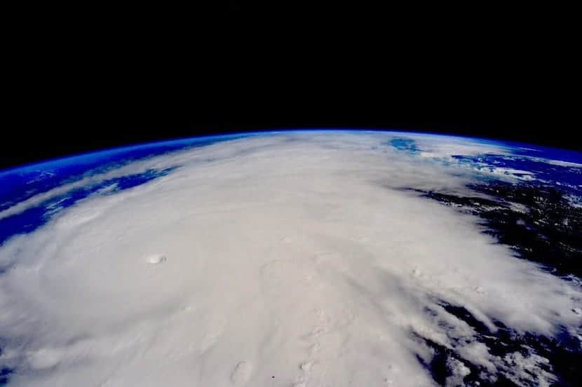
Hurricanes
The devastating effect that a hurricane can have is known to all, especially when it affects inhabited areas where houses and buildings are not prepared to withstand the force that the wind can develop. A hurricane is a violent meteorological phenomenon that originates over tropical oceans, usually in late summer or early fall. Its origin is in a uniform mass of hot and humid air that rises rapidly. The air pressure is distributed symmetrically around the center of the system and the isobars are concentric circles very close to each other. In a hurricane, the wind can reach reach speeds of 250 km / h although the most common values are around 119 km / h. At the center of the hurricane is the so-called "eye", an area without clouds and light winds.
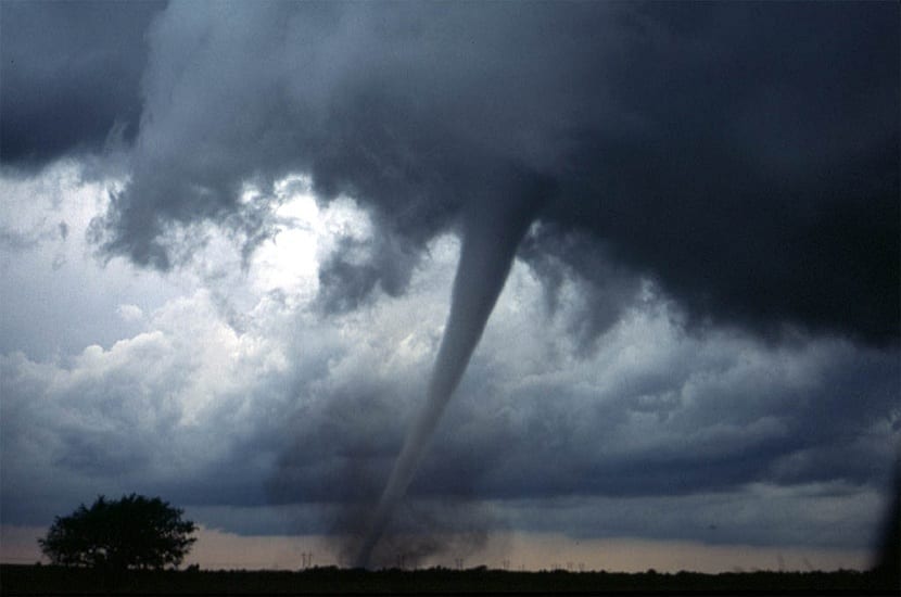
Tornados
It is a swirl of intense winds associated with the formation of cumulonimbus-type stormy clouds. Tornadoes can originate over land or at sea from a rapid rise in very warm air. The movement of the air in the form of a spiral, gives it the typical appearance of a funnel or sleeve. Your tour of the mainland may oscillate between 1,5 km and 160 km in the event of a severe tornado. Those that are generated over the sea are called marine sleeves. The winds that are generated are around 180 km / h, although tornadoes have occurred with speeds of up to 500 km / h.