
Air pollution is sometimes not so easy to perceive, especially if we are inside the polluted city. Only from afar and with the help of the sun's rays can really worrying images of pollution be seen.
The European Space Agency (ESA) has shown the first satellite images on air pollution. It is the first time that pollution can be seen from space thanks to the Sentinel-5P satellite. Do you want to know more about this achievement?
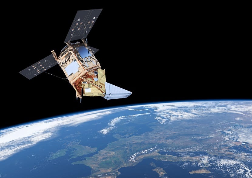
Air pollution from space

The Sentinel-5P satellite was sent last October. Its quality in the resolution of images and data represents a new dimension. The precision and detail with which this data is obtained is like if we could see air pollution in full HD, if we compare them with older lower resolution measurements.
Josef Aschbacher is the director of ESA's Earth Observation Programs, which has been in charge of launching this satellite capable of capturing and displaying air pollution in HD quality.
The satellite has Tropomi installed, the most advanced multispectral imaging spectrometer to date. Thanks to this, the quality of the images obtained is very high. From now on, this satellite will be in charge of measuring the gases found in the atmosphere, among which is nitrogen dioxide, ozone, carbon monoxide, methane, formaldehyde, sulfur dioxide and aerosols. .
Tropomi's pixel size is 7 × 3,5 km2. This allows for daily global coverage and will provide approximately 640GB of information and data per day.
Thanks to this quality of information it will be possible to make measurements like never before. "We are now entering the new era of air quality measurements," said Josef.
"We have around 4.000 wavelengths per spectrum and we measure about 450 spectra per second and twenty million of these observations per day«Said Pepijn Veefkind, from the Royal Netherlands Meteorological Institute, when showing several images created from the data sent by Sentinel-5P.
The goal of the new program is to observe the Earth to provide information on air quality in real time. This will greatly help when making future decisions about climate change. It can also be used to track volcanic ash affecting flights and warning services at high levels of radiation.
The measurement results of this satellite have exceeded expectations, so it can be said that it is something revolutionary.