
Nowadays, thanks to the technology that is developed every day, the human being can predict the weather with more accuracy and precision. One of the technological devices to carry out weather forecasting is the storm radar. As its name suggests, it can help us predict cloudiness thick and unstable enough to cause storms.
In this article we will explain everything you need to know about storm radar, what are its characteristics and usefulness.
What is storm radar
The storm radar is a large instrument that consists of a tower 5 to 10 meters high with a spherical dome covered in white. There are several components (antennas, switches, transmitters, receivers ...) that make up the radar of this dome itself.
The radar's own operating circuits allow estimating the distribution and intensity of rain, either in solid form (snow or hail) or in liquid form (rain). This is essential for meteorological monitoring and surveillance, especially in the most delicate situations, such as very intense storms or heavy rains, where there are very strong and static bands of rain, that is, when a lot of rain accumulates in one place in a short time. time frame.
How Storm Radar Works
The operating principle of storm radar is based on the emission of microwave-type radiation rays. These beams or pulses of radiation travel through the air in the form of several lobes. When the pulse encounters an obstacle, part of the emitted radiation is scattered (scattered) in all directions and part is reflected in all directions. The part of radiation that is reflected and propagated in the direction of the radar is the final signal you receive.
The process involves conducting multiple pulses of radiation, first by positioning the radar antenna at a certain elevation angle. Once the elevation angle of the antenna is set, it will begin to rotate. When the antenna rotates on its own, it emits pulses of radiation.
After the antenna completes its travel, the same procedure is performed to raise the antenna to a certain angle, and so on, to achieve a certain number of elevation angles. This is how you get so-called polar radar data - a set of radar data located on the ground and high in the sky.
The result of the whole process It is called a spatial scan and takes about 10 minutes to complete. The characteristic of the emitted radiation pulses is that they must be very energetic, because most of the emitted energy is lost and only a small part of the signal is received.
Each space scan generates an image, which must be processed before it can be used. This image processing includes various fixes, including the removal of terrain generated false signals, that is, the removal of mountain generated false signals. From the whole process explained above, an image is generated that shows the reflectivity field of the radar. Reflectivity is a measure of the magnitude of the contribution of electromagnetic energy to the radar from each droplet.
History and applications of the past
Before the invention of rain radar, weather forecasts were calculated using mathematical equations, and meteorologists could use mathematical equations to predict the weather. In the 1940s, radars were used to observe enemies in World War II; these radars often detected unknown signals, which are what we now call Yufeng. After the war, scientists mastered the device and turned it into what we now know as rain and / or precipitation radar.
Storm radar is a revolution in meteorology: pallows large meteorological institutions to obtain information for forecasting, And you can also understand in advance the dynamics of the cloud, as well as its path and shape. , The rate and probability of causing precipitation.
The interpretation of the forecast that the precipitation radar gives is complicated, because although it is an advance in the meteorological community, the radar does not provide specific data on the distance, and it is difficult to know the exact location of the meteorological target. This is the spoken language.
To make the most accurate predictions, meteorologists study possible forward movements. When sunlight hits the clouds, the frequency of the electromagnetic waves emitted to the radar changes, allowing us to understand the characteristics of precipitation that can occur.
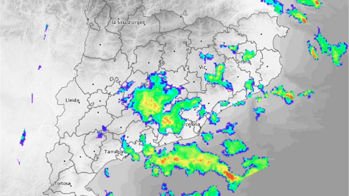
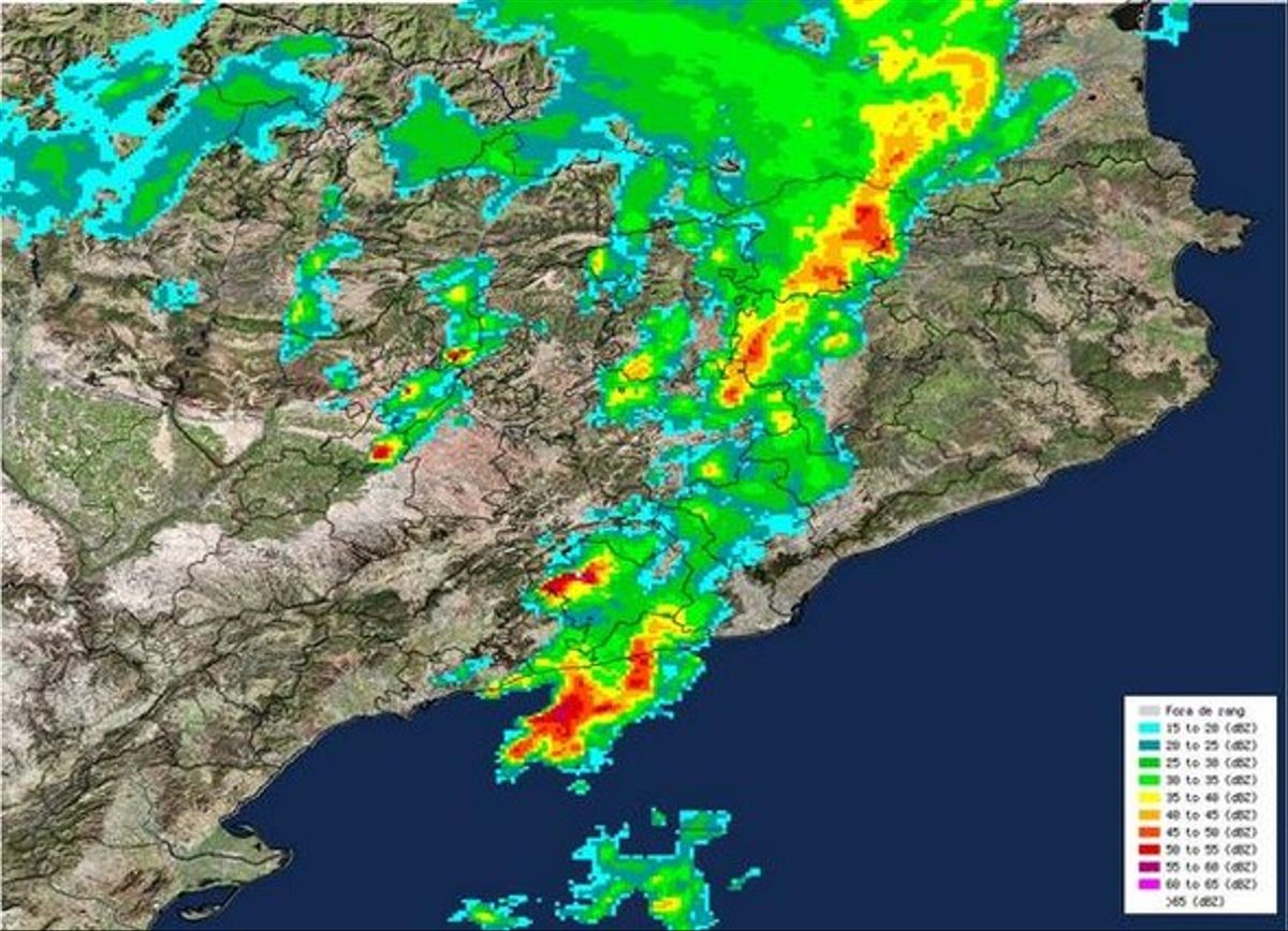
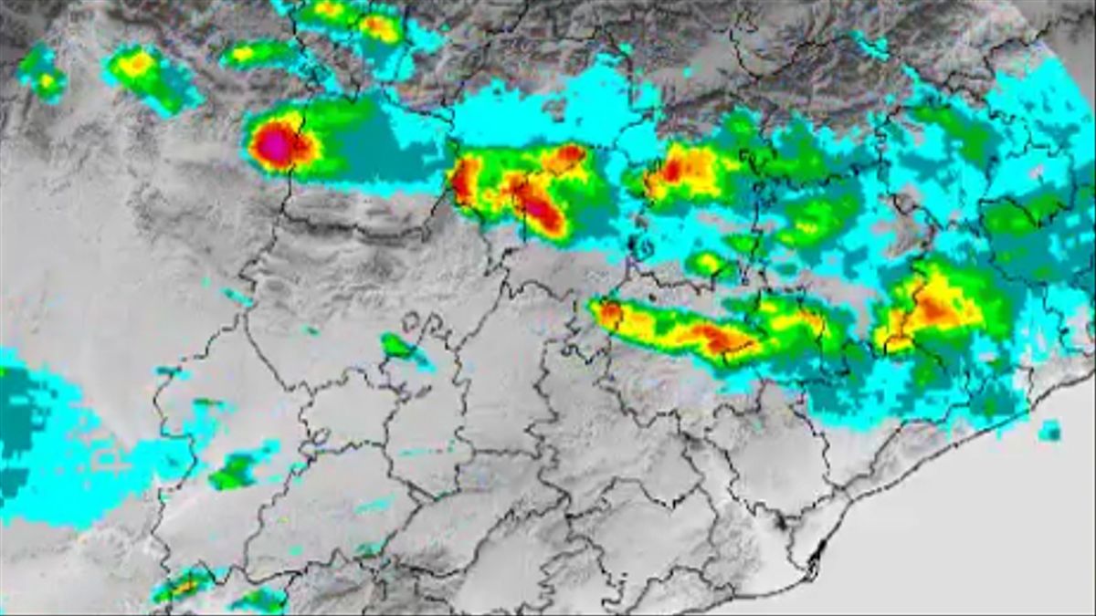
If the change is positive, the front approaches and the probability of precipitation will increase; otherwise, if the change is negative, the front will recede and the probability of precipitation will decrease. When all the information from the radar is transmitted to the computer image, the precipitation front will be classified according to the intensity of rain, hail or snow ... A series of colors are assigned from red to blue according to the intensity of the rain.
Importance in flight planning
The first thing to say is that the weather radar is an observation tool, not a forecast tool, so it shows us the rainfall situation (sweep) when data is collected.
However, by seeing how a large amount of precipitation evolves over time, we can "predict" its future behavior: will it stay in place? Will it move our way? More importantly, can we plan flights to avoid areas with heavy storms and rainfall?
The data collected by the radar is presented in different display formats. Next, we will describe the two most important aspects of flight planning and refer to some other content that they are also extracted from Doppler radar measurements.
As you can see, storm radar is quite useful for weather forecasting and can help us with flight planning. I hope that with this information you can learn more about storm radar and its characteristics.
Quite useful information. The importance and role that this observation tool currently has for understanding the dynamics of the local atmosphere, and without a doubt in warning of disasters due to possible extreme events.