
Image from NASA where you can see from left to right Lake Upembe, Tanganyika (the largest) and Rukwa.
El rift valley It is a great geological bill that began to form about 30 million years ago and that occupies an area of 4830 kilometers in a north-south direction.
Today it is considered the cradle of humanity due to the large number of hominid fossils that have been found there. In addition, Unesco declared the lakes a World Heritage Site in 2011. But, What else is special about this area?
Where are you from?

As we said at the beginning, the Rift Valley began to form about 30 million years ago as a result of the separation of the tectonic plates (Somali, Indian, Arabian and Eurasian). As time passes and the earth's crust is melted by the molten magma that rises to the surface, a long trench is formed with slopes that have a great slope.
The central rocky area regularly fragments, creating faults in which the rock blocks exert a vertical slide. In many areas these blocks sink to form a graben, which is a long depression bordered on both sides by parallel normal faults.
How is your geography?
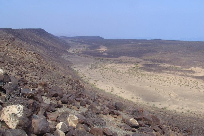
Image - Flickr / Charles Roffey
The Rift Valley, located to the east of the African continent, has an extension of 4830 kilometers. In its eastern part we find the typical African savannas, where the African buffalo, the wildebeest, the giraffe or the lion live; and in the west it hosts jungles, which are the habitat of chimpanzees and gorillas, among others.
There you can also see the Kilimanjaro volcano, which is a mountain located in the northwest of Tanzania formed by three inactive volcanoes (Shira that is located to the west and has an altitude of 3962 meters, Maswenzi that is in the east and measures 5149 meters of altitude and the Uhuru that is in the middle of both that has an altitude of 5891,8 meters), in addition to some of the largest freshwater lakes on the continent, such as Turkana, Tanganyika or Malawi.
As a consequence of the separation exerted by the Rift Valley, in the east of the continent the climate is drier than in the west, which is why in this part of Africa the savannah appeared first, and then the local apes that until then lived in the trees. Some time later they must have become terrestrial, learning to walk on their two hind legs that we know today as legs.
This is a magnificent area to learn more about the most remote past of the human being, since the great rift has exposed hundreds of meters of geological strataSo finding human fossils is not only not a difficult task, it must also be fascinating.
What are the lakes of the Great Rift Valley?
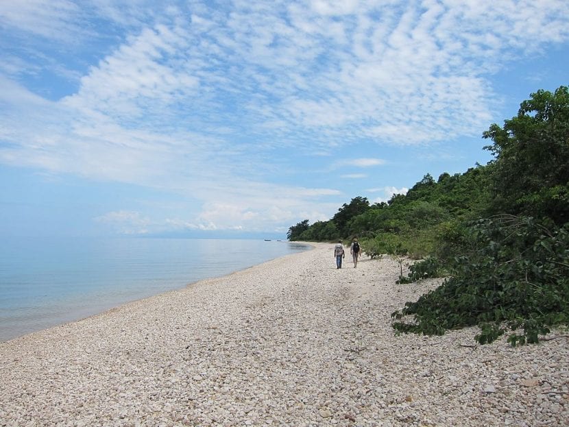
Image - Flickr / fabulousfabs
The lakes that are in this valley are some of the richest in biodiversity in the world. Until now 800 species of cichlid fish have been discovered (bony fish), and there are still many more that are still waiting to be discovered.
But also, although lakes are not very helpful in absorbing greenhouse gases that are emitted by fossil fuels, aerosols and others, they are there is a need to reduce the deforestation of the surroundings and to restore those areas that have been cleared. Forests, both in Africa and anywhere on the planet, do absorb gases such as carbon dioxide, thereby mitigating the effects of climate change.
Their names are:
Ethiopia
- Lake Abaya: of 1162km2
- Chamo Lake: of 551km2
- Lake Ziway: of 485km2
- Shala Lake: of 329km2
- Koka Lake: of 250km2
- Langanao lake: of 230km2
- Abijatta lake: of 205km2
- Awasa Lake: of 129km2
Kenya
- Turkana lake: of 6405km2
- Lake Logipi: it is a shallow lake that is in the Suguta valley
- Baringo Lake: of 130km2
- Lake bogoria: of 34km2
- Lake nakuru: of 40km2
- Elmenteita Lake: shallow lake.
- Naivasha lake: of 160km2
- Lake Magadi: shallow lake located near the border with Tanzania.
Tanzania
- Lake natron- Shallow lake categorized by the World Wildlife Fund as the East African halophytic ecoregion.
- Lake Manyara: of 231km2
- Eyasi lake: shallow seasonal lake
- Makati Lake
Western lakes
- Lake Albert: of 5300km2
- Lake Eduardo: of 2325km2
- Kivu lake: of 2220km2
- Tanganyika lake: of 32000km2
Southern lakes
- Rukwa Lake: about 560km2
- Malawi Lake: of 30000km2
- Malombe Lake: of 450km2
- Chilwa Lake: of 1750km2
Other lakes
- Lake Moero: of 4350km2
- Mweru Wantipa Lake: of 1500km2
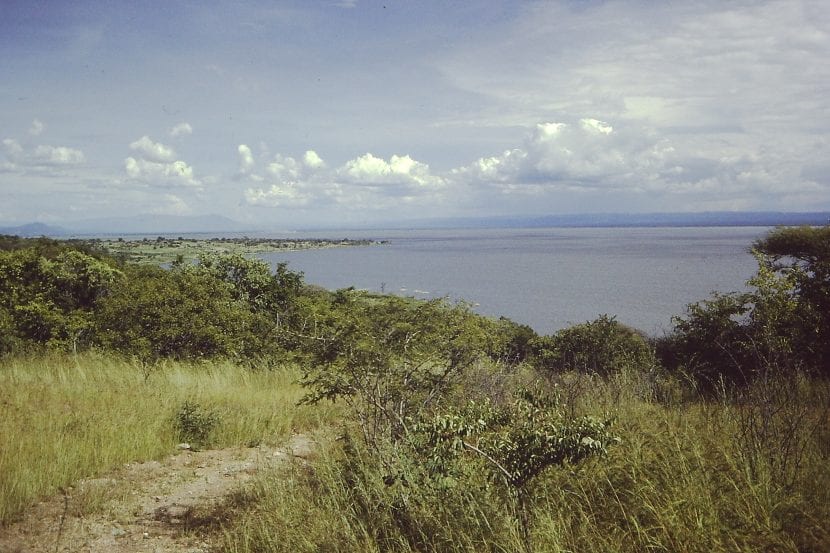
Image - Wikimedia / Lichinga
The Rift Valley is a breathtaking place, full of life. One of those that you have to go see at least once. We hope you enjoyed this article dedicated to the cradle of humanity.