
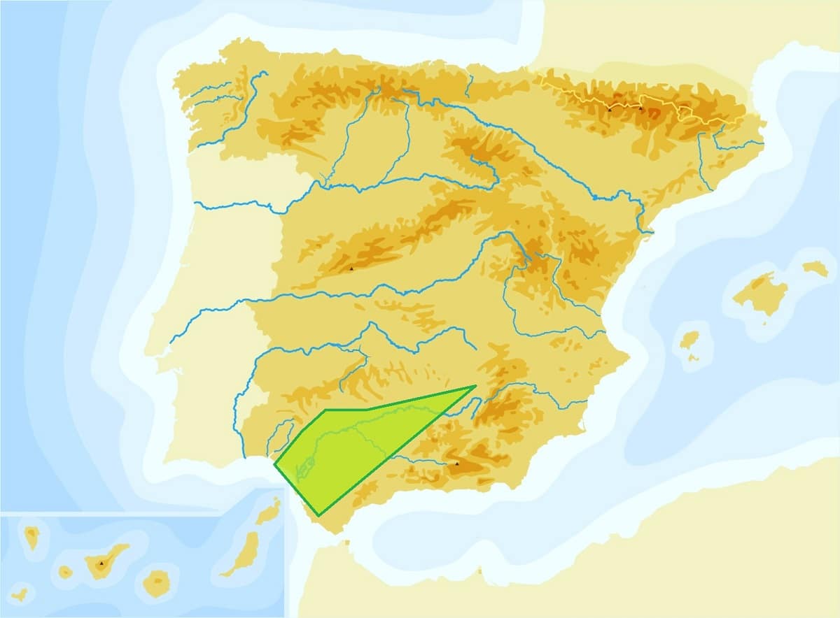
La Guadalquivir depression, also known as the Baetic Depression, is a geographical accident in the south of Spain. This is a triangular plain with a length of 330 kilometers. It reaches a width of 200 kilometers and narrows as it goes east. The depression runs along the edge of the Castilian Plateau and opens onto the Atlantic Ocean, where the Guadalquivir River flows.
In this article we are going to tell all the characteristics, geography and relief of the Guadalquivir depression.
Key features
The Guadalquivir Depression is located in Andalusia, Spain, and is the southernmost region of the country, located in the southern part of the Iberian Peninsula. Its geological and morphological units with all its inherent elements (topography, topography, flora, fauna, etc.) They run through the five provinces of Jaén, Córdoba, Cádiz, Huelva and Seville. Inside there is a protected area, and it is the Doñana National Park.
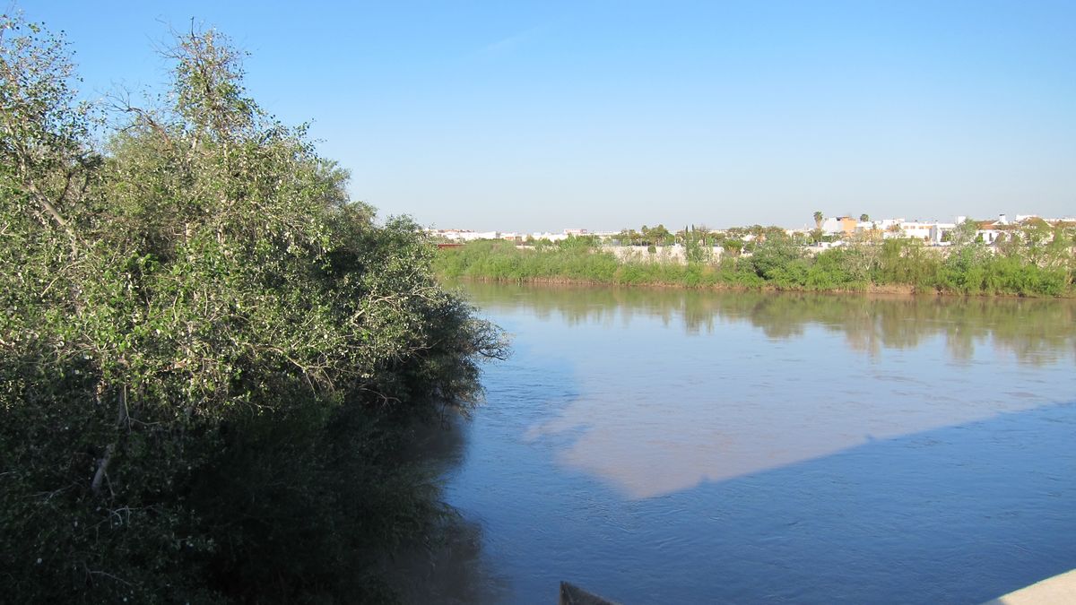
The most important body of river water that runs through this plain is the Guadalquivir. In its final part, the swamps of the same name appear, which are flooded by the action of the river in floods and the tides of the Atlantic Ocean.
The depression is bounded by the Sierra de Bética to the north, the Atlantic Ocean to the south, the Sierra de Penibética to the east and southeast, and the Sierra Morena that separates it from the plateau to the west. More than 600 kilometers of alpine mountains separate the Guadalquivir depression from the Mediterranean coast.
The Penibético sector is the outermost compared to the interior or Subbético sector. There is Sierra Nevada, among which are the mountains, of which Pico Veleta, at 3392 meters above sea level, and Mulhacén, at 3478 meters above sea level, are the highest points in the entire Peninsula. Iberian.
Origin of the Guadalquivir depression
It has been determined that the Guadalquivir Depression originated in the Miocene. It originated from a trench that began with the sinking of marine sediments of the Tertiary caused by mountainous movements. This explains why this plain presents reliefs, whose forms exhibit soft undulations.
In addition, the formation of the depression coincides with the folds of the Sierra Subbética, which suggests that it had an uplifting process. That is to say, in the Guadalquivir depression a moat collapsed, creating a channel, a canal, through which the Atlantic Ocean and the Mediterranean Sea communicated. However, the deposition of the Guadalquivir Valley did not begin until the end of the Tertiary. This was closed in its northern part, leading to the deployment and redistribution of the waters that irrigated the area.
Therefore, these deformations, which did not occur until the Pliocene, drained the seawater from the depression. The growing Betic Mountains have created a new coastline where the mouth of the Guadalquivir emerges. Given the constant presence of river water, the resulting landscape experienced constant erosion. This process destroyed the aforementioned tertiary fill, giving way to a very humid area rich in vegetation.
Finally, marshes appear in the last stretch of the Guadalquivir depression. The frequent flooding of the river allows alluvial deposits to be deposited during the rainy season, in which material is dragged to create terraces and plains with terrestrial debris. The vast majority of these materials are soft, although their hardness can be variable, as evidenced by the topographical differences in the terrain.
Topography
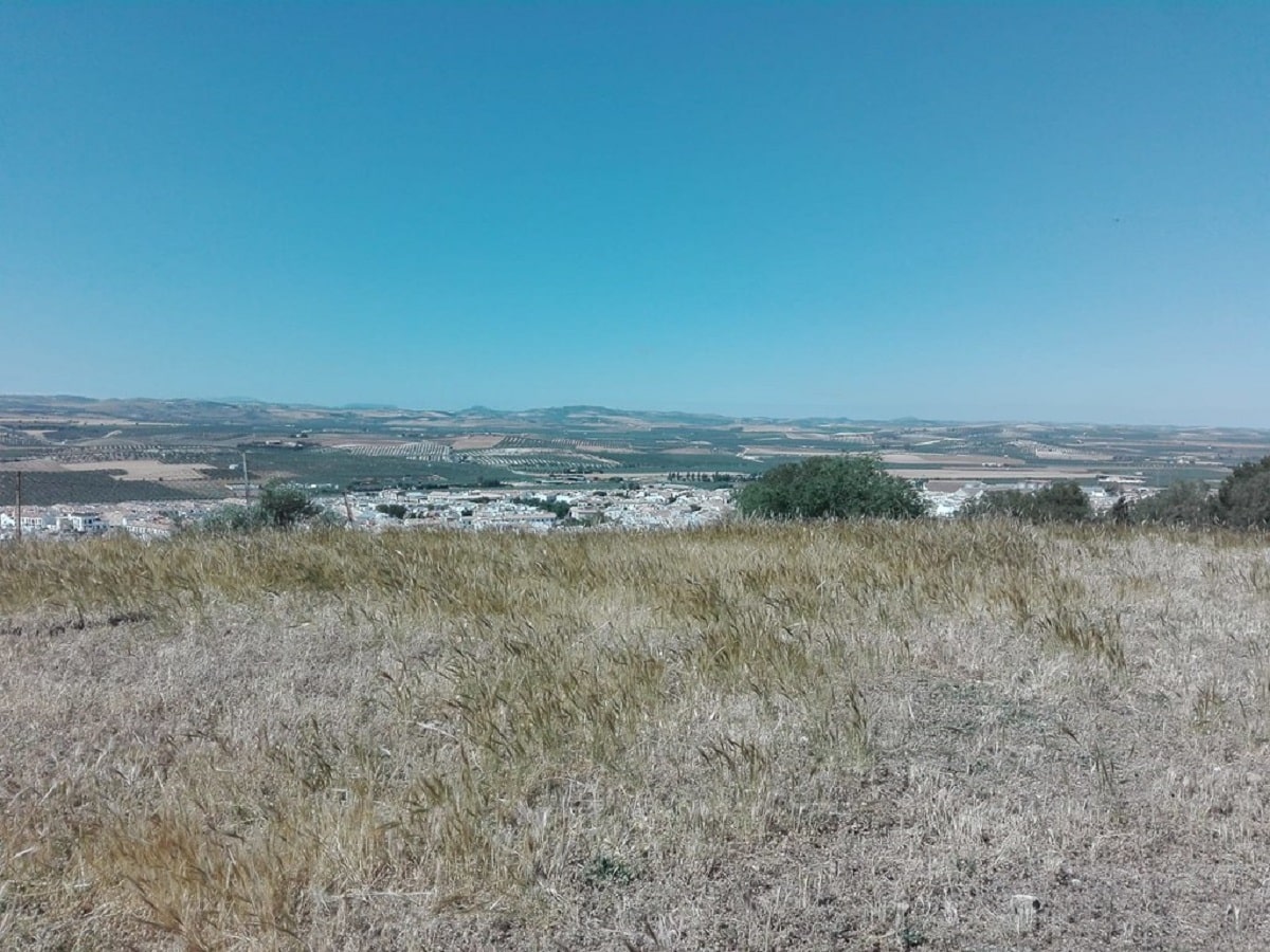
As mentioned earlier, the Guadalquivir depression is 30 kilometers long and 200 kilometers wide, and gets smaller as you go east. In addition, with an average height of 150 meters, few reliefs are observed throughout the plain and almost no mountains are seen on the hills near Chiclana, Jerez, Montilla and Carmona. Limestones or molasses also have a hard horizon.
However, it is not the flat landscape that dominates the Guadalquivir Depression, but the gentle hills. There are rich river valleys surrounded by terraces of widely varying sizes, although the general rule is that the further along the Guadalquivir one goes, the wider the valley becomes, until the western area is flat and marshes are found. In addition, the Guadalquivir Depression is subdivided into four units. Each has its unique morphological and geological characteristics.
Marshes and coast of the Guadalquivir depression
Marshes dominate the landscape, covering 2.000 square kilometers, but have been retreating as seawater seeped into the area through channels and estuaries.
For its part, the coast is very dynamic, with parts of it characterized by coastal arrows and dune cords, which are directly influenced by the currents of the Atlantic Ocean. Also, geological materials are usually soft and fertile, such as gravel, silt, sand, and clay.
This topographic configuration makes a large part of the valley of the Guadalquivir depression suitable for agriculture. There are vegetable crops, cereals, olive trees and fruit trees. Therefore, this part of Spain is very important to the national economy as most of its food comes from there.
It should be noted that the depression of the Guadalquivir cannot be fully described as a plain where plains abound, since this would be a generalization. Although it is true that the reliefs do not have much elevation, there are also hills and mountains that bear witness to the passage of time. At other times, the water level in the Guadalquivir is much higher and, as it erodes the land, it excavates to form terraces and valleys.
Comparison with the Ebro depression
The Ebro depression is a valley in northeastern Spain. The Ebro river crosses it. It is compared with the depression of the Guadalquivir in importance and character, and rightly so, since they share many features, although only the most outstanding can be mentioned.
In addition to being large, both depressions have a triangular shape, covered with tertiary sediments and complex irrigation by river water. Also added to this short list of similarities are the relatively low elevations of the depressions, their relevance to the Spanish, not to mention their apparent antiquity.
However, the depressions of the Guadalquivir and the Ebro also presented innumerable quantitative and qualitative differences. Because they are punctual and specific, they do not fit here, so only three are considered substantial: the geological age, the type of fill and the topography of the valley.
I hope that with this information you can learn more about the Guadalquivir depression and its characteristics.