The basin of Genal river It is located in the western sector of the province of Malaga, within the Serranía de Ronda region, specifically to the south of said municipality, belonging to the southern basin. It is one of the best known rivers in Malaga and has quite curious characteristics.
In this article we are going to tell you all the characteristics, geology and source of the Genal River.
Key features

It is bounded to the east by the Sierra Palmitera and Sierra Bermeja, to the north by the Sierra del Oreganal, to the west by the Dorsal Atajate-Gaucín, the south being the natural exit that connects it with the flysch of the Campo de Gibraltar. This situation makes the Genal valley a very closed and compartmentalized territory with difficult access both from the Ronda plateau, as well as from the Guadiaro valley and the Costa del Sol.
At its head, the basin followed the east-west direction until not long ago. It begins at the confluence with the Gorgot River, where it turns in a northeast-southwest direction. Finally, in the municipal term of Casares, it converges with Guadiaro. It has a north-south direction. As an approximation of its size.
It must be said that the basin covers an area of 343 square kilometers and is wide maximum 19 kilometers, obtained in the cross section in an east-west direction, with a width of at least 6 kilometers. From Sierra Crestellina to The average width of the Guadiaro River in the lower part of the basin is approximately 12,5 kilometers, and the length of the channel, from the Seco River to the confluence with the Guadiaro River is about 62,9 kilometers.
Genal river lithology
The Genal River and its entire basin are made up of 3 lithological domains. These are the following:
- Calcareous materials (limestones, dolomites, marigolds, etc.) are always found on the right bank of the Genal river, from the top of Cascajares to El Hacho, extending from there to the Sierra where Crestellina. Its appearance continued until the end of Atajate, from where it alternated with metamorphic materials (Manto Maláguide), until Gaussine, where carbonate materials reappeared in a dominant way, from the Campo de Gibraltar flysch.
- The metamorphic materials they are those of Mantos Alpujárride and Maláguide (gneiss, schist, mica schist, phyllite, etc.). They are distributed in the center of the basin. They are in contact with the peridotite on the left bank of the river and the calcareous material on the right bank. The continuous east-west thrust morphs into a strong metamorphism, all due to the intrusion of ultramaphics into the peridotite bedrock, such as the Thrust mantle, there are obviously quartzites and gneiss.
- El ultrabasic material is a material found in Sierra Bermeja, a powerful series of peridotite composed of a variety of heavy metals and toxic metals. They are always distributed along the left bank of the Genal River, from its head to Sierra Crestellina, continuously distributed, that's what Sierra is called.
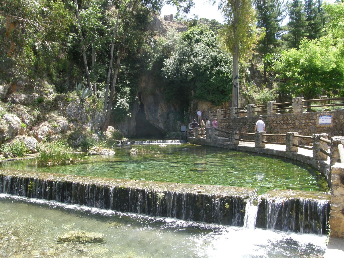
Natural monument of the source of the Genal river
The Natural Monument Nacimiento del Río Genal is a natural outcrop of the Sierra Blanca aquifer, with crystal clear water gushing out of the beautiful hollow internal organs. In the first walk, a tributary of the Guadiaro river separates the street from the garden of the town where he was born: match; a charming white village at the source of the Genal river, in the Serranía de Ronda In the setting, very close to the Sierra de las Nieves Natural Park. The maze of steep streets and large houses clings to the steep walls that penetrate the rocks.
Located in the upper part of the town, adjacent to the recreation area, the water gushes in a charming place full of vegetation, waterfalls and glitter. During the rainy season, when the water level in the river bed increased significantly, what Igualejeños called a spring burst: a huge and impressive explosion of water because spring water is what geologists call a siphon.
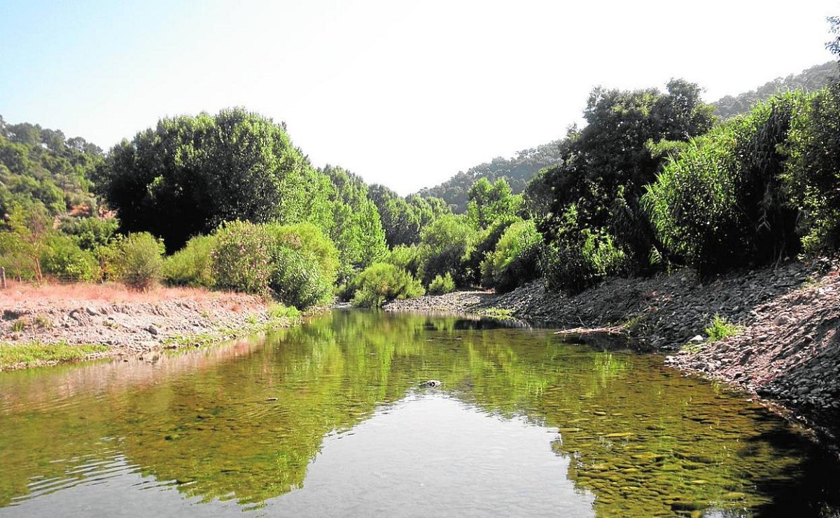
In these broken fields of chestnut and olive trees, leveling is almost impossible. All the hills are gathered in the bed of the Genal, a waterline full of wild leaves, almost inextinguishable by some orchards of domesticated landscapes. The main vegetation along the river is made up of poplars, elms, ash trees, willows and alders, which shade the riverbed along with oleanders, wickers, tamarisk, reeds, barberry and durillo.
Waters from a past miller, in the 60s several dams were built next to the source of the river that allowed it to be repopulated with trout. It is Igualeja land of legends, since in this place three well-known bandits were born: “El Zamarra”, “El Zamarrilla” and “Flores Arrocha”.
Climate and hydrology
Due to the important separation, the diversity of exposure and the important altitude gradient, the climate of the Genal Basin is very different from the point of view of the microclimate, so at a general level two very different areas can be marked:
On the one hand, the lower climate of Genal it is more affected by the ocean, facing the arrival of the Campo de Gibraltar and the unstable front of the Atlantic, which means (lower thermal amplitude, less drought, etc.), it can be extended to Dorsal and Sierra. Bermeja borders Municipalities. On the other hand, the upper part has shown a slight continental shadow (greater thermal amplitude and greater drought).
There are many questions about the source of the Genal River, but most authors agree that the main source is produced by contact with carbonates and metamorphic substances, although it is generally believed that the source is the Igualeja outcrop, which it has 230 l / s. , which constitutes the river the greatest contribution at its source. However, its irregularity prevents the persistence of downstream currents.
Other important contributions are the Nacimiento river, also caused by the discontinuity of the lithology of karst schists, and the outcrop of Júzcar, of 185 l / s, without ignoring the contribution of the Seco and Guadarín rivers on the left bank. It is the general direction of the river in this east-west part.
I hope that with this information you can learn more about the Genal River and its characteristics.